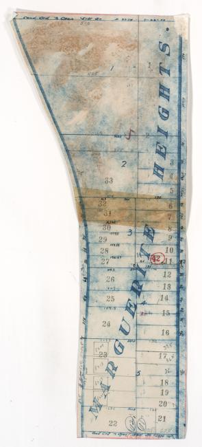
Map of block in the North Town Fork Creek neighborhood, from 51st Street south to 53rd Street, and Swope Parkway east to Cleveland Avenue, containing information about tax assessment values of included properties, and illustrating lot numbers for the block. Photographs of properties on the block can be viewed below.
Hover & Scroll to Zoom
Click to View Full Image File
Request a Building Photo
Any use of the images found in this collection should include the following credit: Missouri Valley Special Collections, Kansas City Public Library, Kansas City, Missouri. To inquire about permissions, please contact Missouri Valley Special Collections at (816) 701-3427 or lhistory@kclibrary.org
This project is supported by the Institute of Museum and Library Services under the provisions of the Library Services and Technology Act as administered by the Missouri State Library, a division of the Office of the Secretary of State.
Identified Buildings from this Block
No building/parcel addresses have been identified for this block folder.