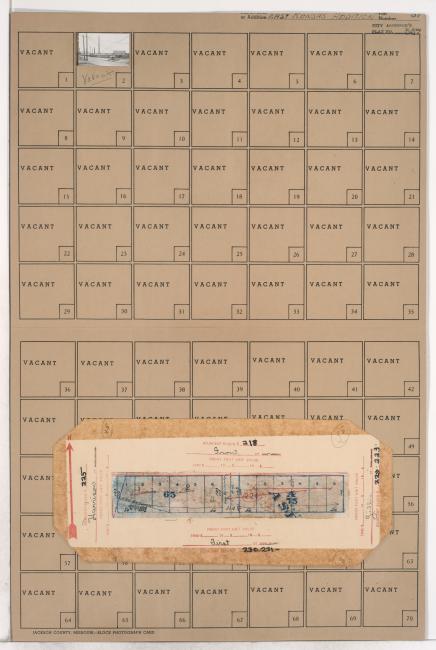
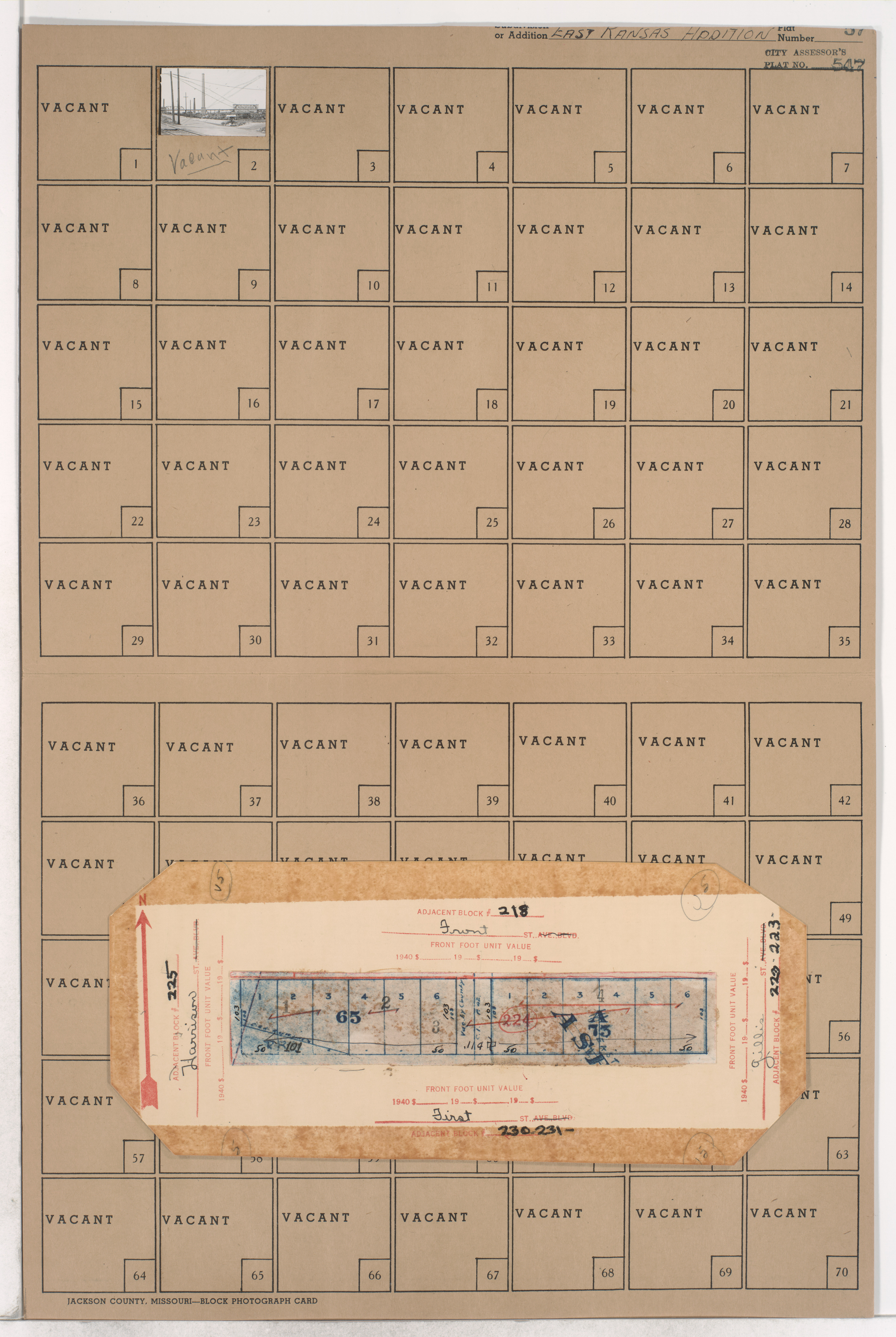
Folder contains a photograph of a Kansas City Gas Company building in the East Kansas addition, from Front Street south to 1st Street, and Campbell Street east to Gillis Street. The A.S.B. Bridge can be seen in the background of the image. Folder also contains plat map of the block.
Hover & Scroll to Zoom
Click to View Full Image File
Request a Building Photo
Any use of the images found in this collection should include the following credit: Missouri Valley Special Collections, Kansas City Public Library, Kansas City, Missouri. To inquire about permissions, please contact Missouri Valley Special Collections at (816) 701-3427 or lhistory@kclibrary.org
This project is supported by the Institute of Museum and Library Services under the provisions of the Library Services and Technology Act as administered by the Missouri State Library, a division of the Office of the Secretary of State.
Identified Buildings from this Block
No building/parcel addresses have been identified for this block folder.