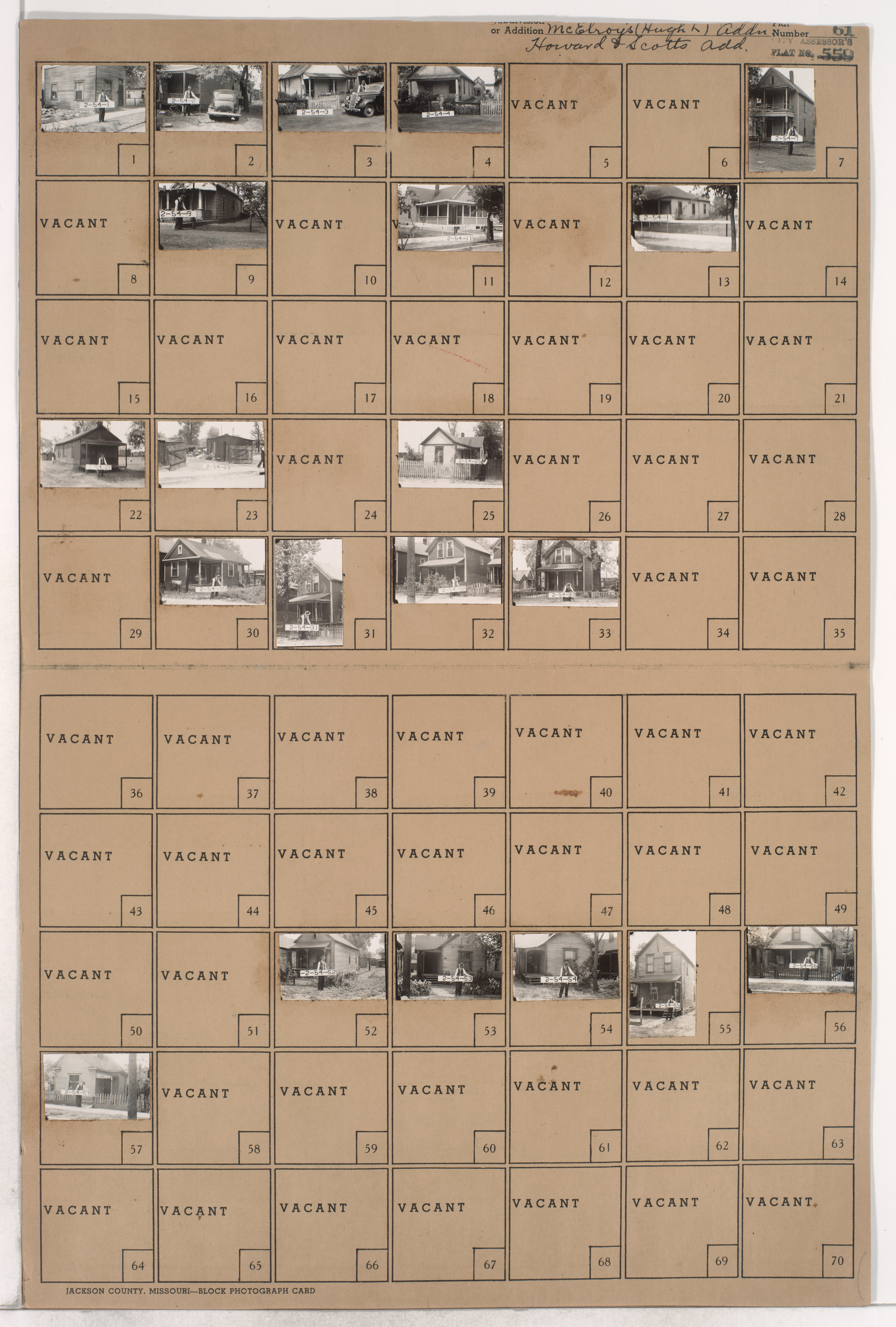
Folder contains photographs of residences in the East Bottoms area, from Rochester Avenue south to Guinotte Avenue, and Olive Street east to Wabash Avenue, bisected by Edgar Avenue.
Hover & Scroll to Zoom
Click to View Full Image File
Request a Building Photo
Any use of the images found in this collection should include the following credit: Missouri Valley Special Collections, Kansas City Public Library, Kansas City, Missouri. To inquire about permissions, please contact Missouri Valley Special Collections at (816) 701-3427 or lhistory@kclibrary.org
This project is supported by the Institute of Museum and Library Services under the provisions of the Library Services and Technology Act as administered by the Missouri State Library, a division of the Office of the Secretary of State.
Identified Buildings from this Block
No building/parcel addresses have been identified for this block folder.