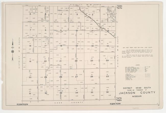
Detail map of the northern section of District 40 of the 1940 tax assessment project. Map illustrates block numbers, appraised values, and plat boundaries, as well as streets and railroads. The map covers an area of south-central Jackson County, Missouri, from roughly Chipman Road south to the Cass County line, and from the District 30 boundary east to Lee's Summit Road.
Any use of the images found in this collection should include the following credit: Missouri Valley Special Collections, Kansas City Public Library, Kansas City, Missouri. To inquire about permissions, please contact Missouri Valley Special Collections at (816) 701-3427 or lhistory@kclibrary.org
This project is supported by the Institute of Museum and Library Services under the provisions of the Library Services and Technology Act as administered by the Missouri State Library, a division of the Office of the Secretary of State.