Automobile dealerships

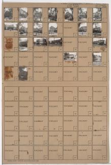
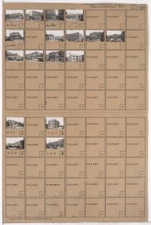
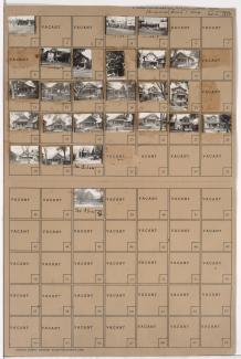
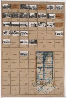
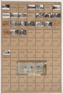
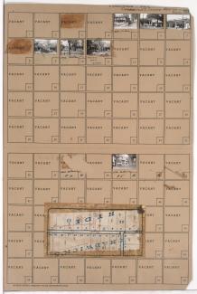
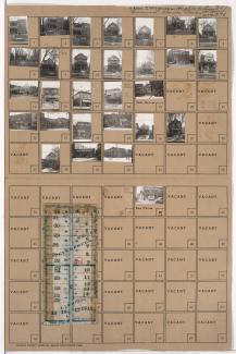
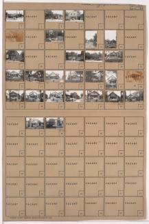
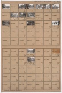
Tax Assessment Block Folder, Kansas City, MO, District 10, Block 202

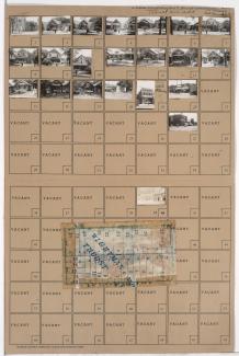
Folder contains photographs of residences, businesses, and other buildings in the Manheim Park neighborhood, from 43rd Street south to 44th Street, and Troost Avenue east to Forest Avenue. Forest Avenue Baptist Church, at 4300 Forest, Nester's Market, at 4335 Troost, and Sunny Side Buffet, at 4343 Troost, are among the buildings pictured. Folder also includes a plat map of the block.

Tax Assessment Block Folder, Kansas City, MO, District 10, Block 179

Folder contains photographs of residences and businesses in the Manheim Park neighborhood, from 42nd Street south to 43rd Street, and Troost Avenue east to Forest Avenue. Dr. Salsbury's Laboratories, at 4243 Troost, and Gershon & Schiff Meat Market, at 4215 Troost, are among the buildings pictured. Folder also includes a plat map of the block, which can be viewed below.

Tax Assessment Block Folder, Kansas City, MO, District 11, Block 6

Folder contains photographs of businesses and other buildings in the North Hyde Park neighborhood, from 31st Street south to Linwood Boulevard, and Gillham Road east to Holmes Street. Borden's Home Dairy, on Holmes, and Kate Hickle's French Laundry, at 3121 Gillham, are among the buildings pictured. Folder also includes a plat map of the block.

Tax Assessment Block Folder, Kansas City, MO, District 11, Block 287

Folder contains photographs of residences, businesses, and other buildings in the Westport neighborhood, from 39th Terrace south to Westport Road, and Broadway Boulevard and Washington Street east to Central Street, including a section of 40th Street. Westport Laundry Company, at 3954 Central, Wayne's Body & Fender Works, at 4045 Broadway, are among the buildings pictured. Folder also includes a plat map of the block.

Tax Assessment Block Folder, Kansas City, MO, District 11, Block 267

Folder contains photographs of residences, businesses, and other buildings in the South Hyde Park neighborhood, from 45th Street south to Brush Creek Boulevard, and Harrison Street and Gillham Road east to Troost Avenue. McClure-Norrington Chevrolet Company, at 4506 Troost, and Gibbs Auto Sales, at 4512 Troost, are among the buildings pictured. Folder also includes a plat map of the block.

Tax Assessment Block Folder, Kansas City, MO, District 11, Block 72

Folder contains photographs of residences and businesses in the Old Hyde Park neighborhood, from 34th Terrace south to Armour Boulevard, and Main Street east to Warwick Boulevard. The Rosery Flowers, on Main, is among the buildings pictured. Folder also includes a plat map of the block.

Tax Assessment Block Folder, Kansas City, MO, District 8, Block 272

Folder contains photographs of residences, businesses, and apartment buildings in the Santa Fe neighborhood, from 30th Street south to 31st Street, and Prospect Avenue east to Montgall Avenue. Anchor Hardware, at 31st and Montgall, is among the buildings pictured. Folder also includes a plat map of the block.

Tax Assessment Block Folder, Kansas City, MO, District 7, Block 107

Folder contains photographs of residences and other buildings in the West Blue Valley neighborhood, from 14th Street south to 15th Street (later Truman Road), and Topping Avenue east to White Avenue. The Centropolis Baptist Church, at 14th and White, is among the buildings pictured.