Bridges

District No. 2 South Industrial Map, Kansas City, Jackson County, Missouri

Detail map of the southern industrial section of District 2 of the 1940 tax assessment project. Map illustrates block numbers, appraised values, and plat boundaries, as well as railroad lines, streets, bridges, and rivers. The map covers an area from the Missouri River south to 5th Street and Independence Avenue, and from Broadway Boulevard east to Troost Avenue.
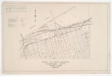
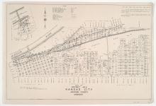
District No. 2 South and West Maps, Kansas City, Jackson County, Missouri

Detail maps of the southern and western sections of District 2 of the 1940 tax assessment project. Maps illustrate block numbers, appraised values, and plat boundaries, as well as railroad lines, bridges, streets, and rivers. The southern map covers an area from the Missouri River and Rochester Avenue south to Independence Avenue, and Delaware Ave east to Troost Avenue; and the western map covers an area from the Missouri River south to 5th Street, and Broadway Boulevard east to Delaware Street.