Churches

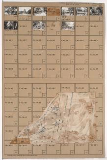
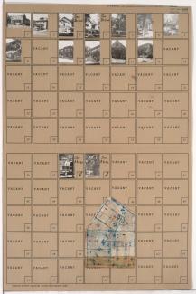
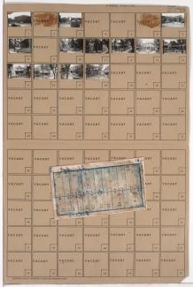
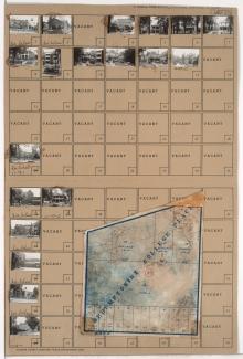
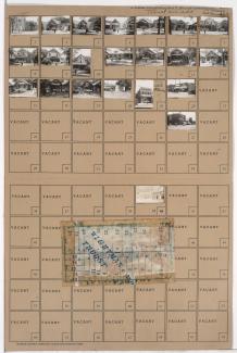
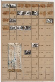
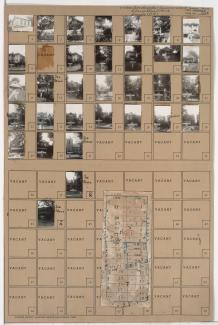
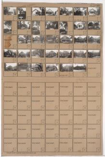
Tax Assessment Block Folder, Kansas City, MO, District 13, Block 1

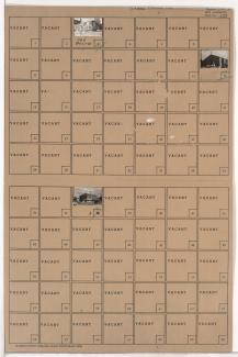
Folder contains photographs of businesses and other buildings in the Ivanhoe neighborhood, from Brush Creek south to Swope Parkway, and Paseo Boulevard east to Prospect Avenue, including sections of Park Avenue, Olive Street, and Wabash Avenue. Parkway Tire Shop, at 4736 Prospect, and St. Mary's Catholic Church, at 2322 Swope Parkway, are among the buildings pictured. Folder also includes a plat map of the block, which can be viewed below.

Tax Assessment Block Folder, Kansas City, MO, District 12, Block 73

Folder contains photographs of residences and other buildings in the Crestwood neighborhood, from 54th Street south to 55th Street, and Westover Road east to Oak Street, including a section of Brookside Boulevard. The Brookside Hotel, at 5401 Brookside Boulevard, and the Second Presbyterian Church, at 55th and Oak, are among the buildings pictured. Folder also includes a plat map of the block.

Tax Assessment Block Folder, Kansas City, MO, District 11, Block 299

Folder contains photographs of residences and other buildings in the Westport neighborhood, from Westport Road and 40th Street south to Archibald Avenue, and Central Street east to Baltimore Avenue. Westport Assembly of God, at 104-108 Archibald, and Westport Presbyterian Church, at 201 Westport Road, are among the buildings pictured. Folder also includes a plat map of the block.

Tax Assessment Block Folder, Kansas City, MO, District 11, Block 60

Folder contains photographs of residences and businesses in the Old Hyde Park neighborhood, from 34th Street south to Armour Boulevard, and Baltimore Avenue east to Main Street. All Souls Unitarian Church, at 3425 Baltimore, is among the buildings pictured. Folder also includes a plat map of the block.

Tax Assessment Block Folder, Kansas City, MO, District 11, Block 49

Folder contains photographs of residences, apartments, and other buildings in the Old Hyde Park neighborhood, from Linwood Boulevard south to 34th Street, and Broadway Boulevard east to Wyandotte Street. Our Lady of Perpetual Help Catholic Church, at 3333 Broadway, and Redemptorist School, at 225 West Linwood, are among the buildings pictured. Folder also includes a plat map of the block.

Tax Assessment Block Folder, Kansas City, MO, District 10, Block 202

Folder contains photographs of residences, businesses, and other buildings in the Manheim Park neighborhood, from 43rd Street south to 44th Street, and Troost Avenue east to Forest Avenue. Forest Avenue Baptist Church, at 4300 Forest, Nester's Market, at 4335 Troost, and Sunny Side Buffet, at 4343 Troost, are among the buildings pictured. Folder also includes a plat map of the block.

Tax Assessment Block Folder, Kansas City, MO, District 10, Block 192

Folder contains photographs of residences and other buildings in the Ivanhoe Southeast neighborhood, from 43rd Street south to 44th Street, and Euclid Avenue east to Garfield Avenue. A Reorganized Church of Latter Day Saints, at 4300 Garfield, is among the buildings pictured. Folder also includes a plat map of the block.

Tax Assessment Block Folder, Kansas City, MO, District 10, Block 181

Folder contains photographs of residences and other buildings in the Manheim Park neighborhood, from 42nd Street south to 43rd Street, and Tracy Avenue east to Virginia Avenue. Immanuel Evangelical Lutheran Church, at 3200 East 42nd, is among the buildings pictured. Folder also includes a plat map of the block.