Gasoline pumps

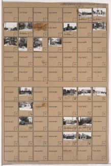
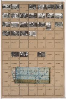
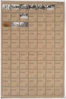
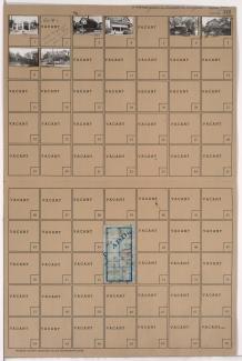
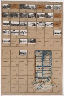
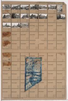
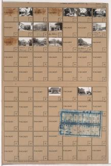
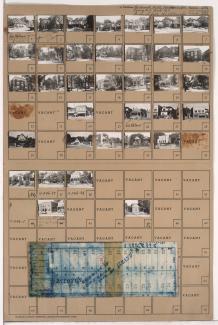
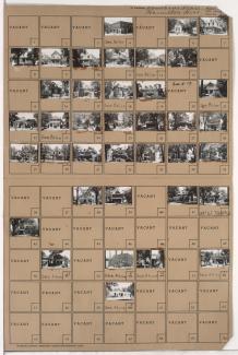
Tax Assessment Block Folder, Kansas City, MO, District 9, Block 297

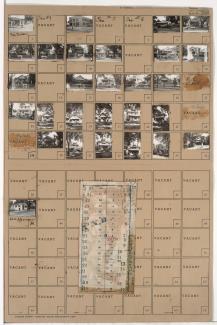
Folder contains photographs of residences and businesses in the Oak Park Southeast neighborhood, from 39th Street south to 40th Street, and College Avenue east to Indiana Avenue. Fire Station Number 4, at 3906 Indiana, is among the buildings pictured. Folder also includes a plat map of the block.

Tax Assessment Block Folder, Kansas City, MO, District 11, Block 294

Folder contains photographs of residences and other buildings in the Westport neighborhood, from 40th Street south to Westport Road, and Waddell Avenue east to Mill Street. Kansas City Public Service Company building, at 40th and Waddell, and South Side Wood and Coal Company, at 536 Westport Road, are among the buildings pictured. Folder also includes a plat map of the block, which can be viewed below.

Tax Assessment Block Folder, Kansas City, MO, District 11, Block 292

Folder contains photographs of residences and other buildings in the Westport neighborhood, from 39th Street south to 39th Terrace, and Waddell Avenue south to Pennsylvania Avenue. Adolph Hapke Jewelry Store, at 721 East 39th, and Janoe's Bakery, at 727 West 39th, are among the buildings pictured. Folder also includes a plat map of the block.

Tax Assessment Block Folder, Kansas City, MO, District 11, Block 287

Folder contains photographs of residences, businesses, and other buildings in the Westport neighborhood, from 39th Terrace south to Westport Road, and Broadway Boulevard and Washington Street east to Central Street, including a section of 40th Street. Westport Laundry Company, at 3954 Central, Wayne's Body & Fender Works, at 4045 Broadway, are among the buildings pictured. Folder also includes a plat map of the block.

Tax Assessment Block Folder, Kansas City, MO, District 11, Block 281

Folder contains photographs of residences, businesses, and other buildings in the Westport neighborhood, from 39th Street south to Westport Road, and Baltimore Avenue east to Main Street. Foster's Shoes, at Westport and Main, Christmas Barbershop, at 2 Westport Road, and Hyde Park Christian Church, at 39th and Baltimore, are among the buildings pictured. Folder also includes a plat map of the block.

Tax Assessment Block Folder, Kansas City, MO, District 11, Block 257

Folder contains photographs of residences, businesses, and other buildings in the Southmoreland neighborhood, from 43rd Street south to 44th Street, and Main Street east to Walnut Street. The Karnopp Building, at 43rd and Main, is among the buildings pictured. Folder also includes a plat map of the block.

Tax Assessment Block Folder, Kansas City, MO, District 11, Block 206

Folder contains photographs of residences, businesses, and other buildings in the Roanoke neighborhood, from 38th Street south to 39th Street, and Roanoke Road east to Summit Street (later Southwest Trafficway). Summit Cleaners, at 800-804 East 39th, is among the buildings pictured.