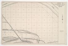
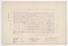
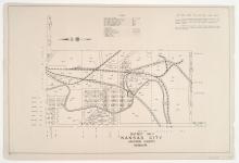
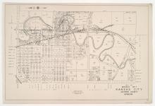
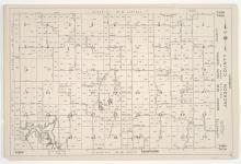
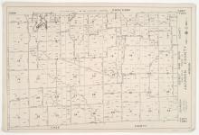
Maps

Districts No. 61-64 Maps and District 60 Platted Area Maps 60 A-A, B, C, F, & I Kansas City, Jackson County, Missouri

Small detail maps of Districts 61 through 64, and platted areas A-A, B, C, F, and I in District 60 in southwestern Jackson County, Missouri. Maps illustrate block numbers, appraised values, and plat boundaries, as well as streets, railroads, and lakes. Map of District 61 and 60B cover the Buckner area. Map of District 62 covers the Grain Valley area. Map of District 63 and 60A-A cover the Levasy area. Map of District 64 covers the Oak Grove area. Map 60C covers the Lake City area. Map 60F covers the Tarsney Lakes area. Map 60I covers the Lone Jack area.

Districts No. 51 & 52 Maps and Platted Area Maps 50 A-I & 60 D-E, Jackson County, Missouri

Small detail maps of Districts 51 and 52, and platted areas A through I in District 50 and D through E in District 60 in the western half of Jackson County, Missouri. Maps illustrate block numbers, appraised values, and plat boundaries, as well as streets, railroads, and rivers. Maps for District 51, 50D, 60D and 60E cover the Blue Springs area, from north of Lockert Road south to South Avenue, and from west of Ashley Avenue to east of State Highway 7. District 52 covers the Lee's Summit area, from Orchard Street south to U.S. Highway 50.

District No. 7 North Map, Kansas City, Jackson County, Missouri

Detail map of the northern half of District 7 of the 1940 tax assessment project. Map illustrates block numbers, appraised values, and plat boundaries, as well as railroad lines, streets, rivers, and other features. The map covers an area from Independence Avenue south to 31st Street, and from Topping Avenue east to Kansas City's 1940 eastern city limits.

District No. 60 South Central (Ranges 29 & 30, Township 48) Map, Jackson County, Missouri

Detail maps of the south central section of District 60 of the 1940 tax assessment project. Map illustrates block numbers, appraised values, and plat boundaries, as well as streets and lakes. Map covers an area of southwestern Jackson County, from U.S. Highway 40 south to Hammond Road, and from west of Highway 7 east to the Lafayette County line.

District No. 60 South (Ranges 29 & 30, Township 47) Map, Jackson County, Missouri

Detail maps of the southern section of District 60 of the 1940 tax assessment project. Map illustrates block numbers, appraised values, and plat boundaries, as well as streets and lakes. Map covers an area of southwestern Jackson County, from Hammond Road south to the Cass County line, and from Harris Road east to the Lafayette County line.