Maps

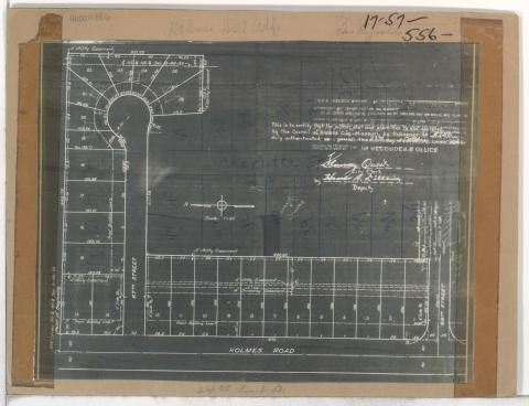
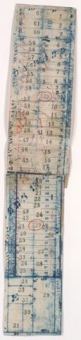
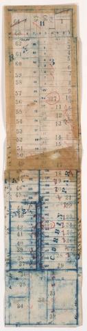
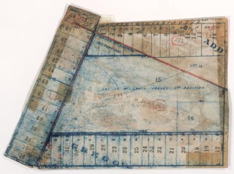
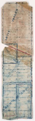
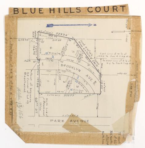
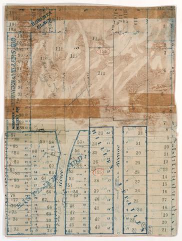
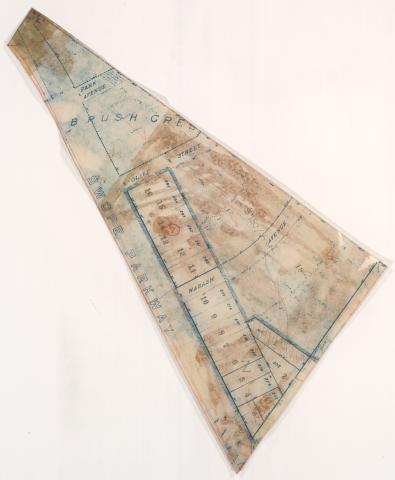
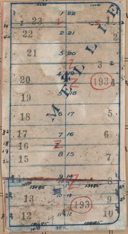
Tax Assessment Block Map, Kansas City, MO, District 17, Block 60

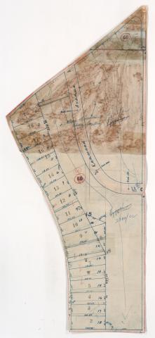
Map of block in the Oak Meyer Gardens neighborhood, from Rockhill Road south to 69th Street, and Cherry Street east to Holmes Road, including a section of Kenwood Avenue, containing information about tax assessment values of included properties, and illustrating lot numbers for the block. Photographs of properties on the block can be viewed below.

Tax Assessment Block Map, Kansas City, MO, District 17, Block 57

Map of block in the Holmes Park neighborhood, from 67th Street south to 68th Street, and Holmes Road east to Troost Avenue, containing information about tax assessment values of included properties, and illustrating lot numbers for the block. Photographs of properties on the block can be viewed below.

Tax Assessment Block Map, Kansas City, MO, District 11, Block 339

Map of block in the the Plaza/Westport neighborhood, from 44th Street south to 46th Street, and Washington Street east to Broadway Boulevard, containing information about tax assessment values of included properties, and illustrating lot numbers for the block. Photographs of properties on the block can be viewed below.

Tax Assessment Block Map, Kansas City, MO, District 11, Block 337

Map of block in the the Plaza/Westport neighborhood, from 44th Street south to 46th Street, and Jefferson Street east to Pennsylvania Avenue, containing information about tax assessment values of included properties, and illustrating lot numbers for the block. Photographs of properties on the block can be viewed below.

Tax Assessment Block Map, Kansas City, MO, District 11, Block 375

Map of block in the the Volker neighborhood, from 41st Terrace south to 42nd Street, and Holly Street east to Roanoke Road, including a section of 41st Place, containing information about tax assessment values of included properties, and illustrating lot numbers for the block. Photographs of properties on the block can be viewed below.

Tax Assessment Block Map, Kansas City, MO, District 11, Block 371

Map of block in the the Volker neighborhood, from 41st Street south to Westport Road, and Roanoke Road east to Clark Avenue, containing information about tax assessment values of included properties, and illustrating lot numbers for the block. Photographs of properties on the block can be viewed below.

Tax Assessment Block Map, Kansas City, MO, District 13, Block 156

Map of block in the Blue Hills neighborhood, from 60th Street south to 62nd Street, and Park Avenue east to Prospect Avenue, including sections of Wabash Avenue and Olive Street, containing information about tax assessment values of included properties, and illustrating lot numbers for the block.

Tax Assessment Block Map, Kansas City, MO, District 13, Block 155

Map of block in the Blue Hills neighborhood, from 60th Street south to 62nd Street, and Park Avenue east to Prospect Avenue, including sections of Wabash Avenue and Olive Street, containing information about tax assessment values of included properties, and illustrating lot numbers for the block. Photographs of properties on the block can be viewed below.

Tax Assessment Block Map, Kansas City, MO, District 13, Block 1

Map of block in the Oak Park Southeast neighborhood, from 41st Street south to 43rd Street, and College Avenue east to Indiana Avenue, containing information about tax assessment values of included properties, and illustrating lot numbers for the block. Photographs of properties on the block can be viewed below.