Restaurants

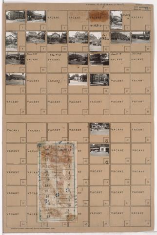
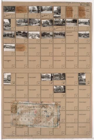
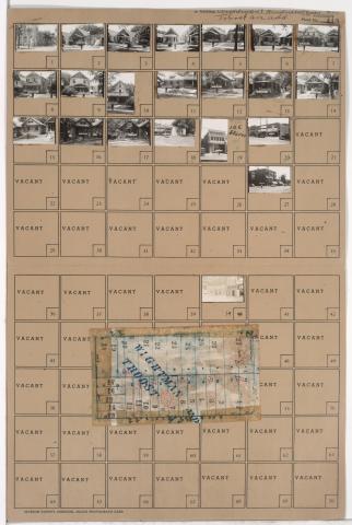
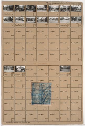
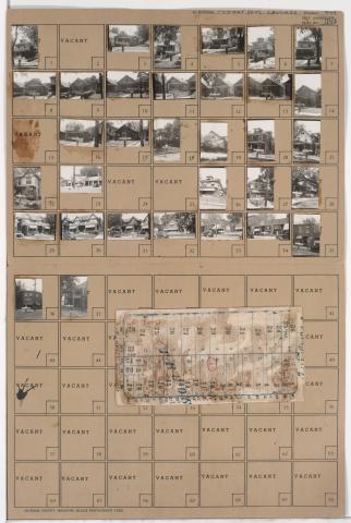
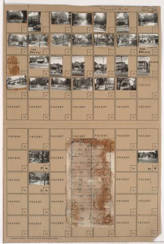
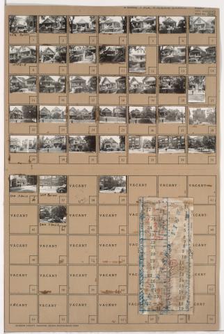
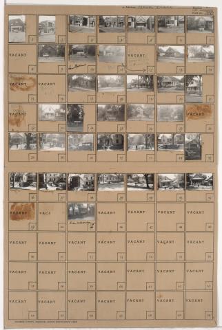
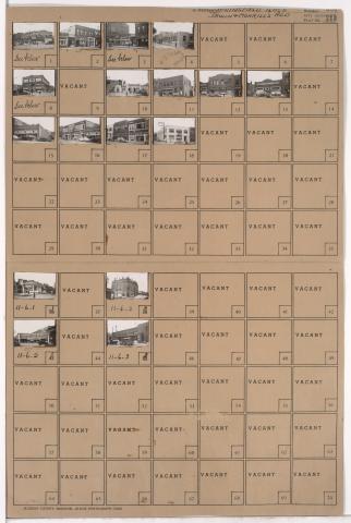
Tax Assessment Block Folder, Kansas City, MO, District 11, Block 1

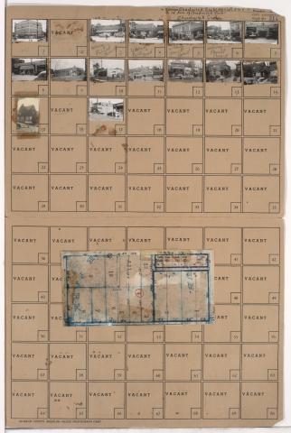
Folder contains photographs of residences, businesses, and other buildings in the North Hyde Park neighborhood, from 31st Street south to Linwood Boulevard, and Harrison Street east to Troost Avenue. The Wirthman Building, including the Isis Theater and Crown Drugs, at 3100 Troost, Gehr's Cafe, at 3128 Troost, and a Woolworth's store, at 3118-3120 Troost, are among the buildings pictured. Folder also includes a plat map of the block.

Tax Assessment Block Folder, Kansas City, MO, District 10, Block 232

Folder contains photographs of residences, businesses, and apartment buildings in the Manheim Park neighborhood, from 46th Street south to 47th Street, and Troost Avenue east to Forest Avenue. Lewis Appliance Company, at 47th and Troost, and an A&P Supermarket, at 4625-4627 Troost, are among the buildings pictured. Folder also includes a plat map of the block.

Tax Assessment Block Folder, Kansas City, MO, District 10, Block 231

Folder contains photographs of residences, businesses, and apartment buildings in the Manheim Park neighborhood, from 45th Street south to 46th Street, and Troost Avenue east to Forest Avenue. Ervin Feld Motor Company, at 4535 Troost, is among the buildings pictured. Folder also includes a plat map of the block.

Tax Assessment Block Folder, Kansas City, MO, District 10, Block 202

Folder contains photographs of residences, businesses, and other buildings in the Manheim Park neighborhood, from 43rd Street south to 44th Street, and Troost Avenue east to Forest Avenue. Forest Avenue Baptist Church, at 4300 Forest, Nester's Market, at 4335 Troost, and Sunny Side Buffet, at 4343 Troost, are among the buildings pictured. Folder also includes a plat map of the block.

Tax Assessment Block Folder, Kansas City, MO, District 11, Block 52

Folder contains photographs of residences and businesses in the Valentine neighborhood, from 33rd Street south to 34th Street, and Summit Street east to Jefferson Street. Stack's Pharmacy, at 3301 Summit, and Sol's Market, at 3305 Summit, are among the buildings pictured. Folder also includes a plat map of the block.

Tax Assessment Block Folder, Kansas City, MO, District 10, Block 178

Folder contains photographs of residences and businesses in the Manheim Park neighborhood, from 41st Street south to 42nd Street, and Troost Avenue east to Forest Avenue. The Man Who Dyes for a Living, at 4109 Troost, is among the buildings pictured. Troost Recreation, at 4103 Troost, and Reynold's Cafe, at 4107 1/2 Troost, are among the buildings pictured. Folder also includes a plat map of the block.

Tax Assessment Block Folder, Kansas City, MO, District 10, Block 163

Folder contains photographs of residences, businesses, and apartment buildings in the Manheim Park neighborhood, from 40th Street south to 41st Street, and Troost Avenue east to Forest Avenue. Lindbergh Theater, at 4011 Troost, and Yukon Cleaners, at 4035 Troost, are among the buildings pictured. Folder also includes a plat map of the block.

Tax Assessment Block Folder, Kansas City, MO, District 10, Block 155

Folder contains photographs of residences, businesses, and other buildings in the Ivanhoe Southwest neighborhood, from 39th Street south to 40th Street, and Highland Avenue east to Woodland Avenue. Velvet Freeze Ice Cream, at 3900 Woodland, and Woodland Beauty Shop, at 3902 Woodland, are among the buildings pictured.

Tax Assessment Block Folder, Kansas City, MO, District 11, Block 6

Folder contains photographs of businesses and other buildings in the North Hyde Park neighborhood, from 31st Street south to Linwood Boulevard, and Gillham Road east to Holmes Street. Borden's Home Dairy, on Holmes, and Kate Hickle's French Laundry, at 3121 Gillham, are among the buildings pictured. Folder also includes a plat map of the block.