Catherine Purdom's Addition

Tax Assessment Block Folder, Kansas City, MO, District 11, Block 294

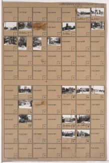
Folder contains photographs of residences and other buildings in the Westport neighborhood, from 40th Street south to Westport Road, and Waddell Avenue east to Mill Street. Kansas City Public Service Company building, at 40th and Waddell, and South Side Wood and Coal Company, at 536 Westport Road, are among the buildings pictured. Folder also includes a plat map of the block, which can be viewed below.
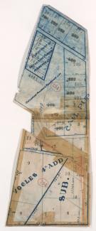
Tax Assessment Block Map, Kansas City, MO, District 11, Block 294

Map of block in the Westport neighborhood, from 40th Street south to Westport Road, and Waddell Avenue east to Mill Street, containing information about tax assessment values of included properties, and illustrating lot numbers for the block. Photographs of properties on the block can be viewed below.

Tax Assessment Block Folder, Kansas City, MO, District 11, Block 295

Folder contains photographs of residences, businesses, and other buildings in the Westport neighborhood, from 40th Street south to Westport Road, and Mill Street east to Pennsylvania Avenue. Manor Baking Company, at 4026-4050 Pennsylvania, Sawyer Material & Coal Company, at 530 Westport Road, and Kelly's Westport Inn, at Westport and Pennsylvania, are among the buildings pictured. Folder also includes a plat map of the block.