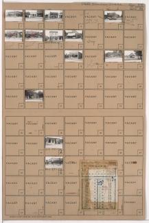
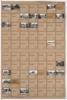
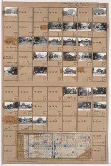
Tax Assessment Block Folder, Kansas City, MO, District 7, Block 122

Folder contains photographs of residences in the East Blue Valley neighborhood, from 16th Street south to 16th Terrace, and Corrington Avenue east to Crystal Avenue. Folder also contains a plat map of the block.