Diamond Petroleum Company

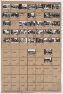
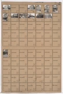
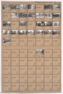
Tax Assessment Block Folder, Kansas City, MO, District 11, Block 316

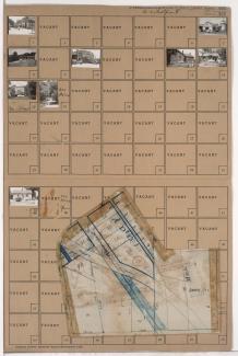
Folder contains photographs of residences, businesses, and other buildings in the Plaza/Westport neighborhood, from 42nd Street south to 43rd Street, and Wornall Road east to Mill Creek Parkway (later Broadway), including a section of Pennsylvania Avenue. R. L. Sweet Lumber Company, at 200 West 43rd, Plaza Laundry, at 501 West 42nd, and the Penn School, at 4237 Pennsylvania, are among the buildings pictured. Folder also includes a plat map of the block.

Tax Assessment Block Folder, Kansas City, MO, District 2, Block 294

Folder contains photographs of businesses and other buildings in the Old Town addition, from 2nd Street south to 3rd Street, and Walnut Street east to Grand Avenue. Singer and Sons Produce Co., at 206 Grand, and a Western Union office, at 215 Walnut, are among the buildings pictured.

Tax Assessment Block Folder, Kansas City, MO, District 1, Block 151

Folders contain photographs of residences and businesses in the Gladstone Heights subdivision, from Thompson Avenue south to Independence Avenue, and Cypress Avenue east to Elmwood Avenue. A.J. Paden Sheet Metal Works, at 4510 Independence Avenue, and a Diamond gas station, at 4514 Independence Avenue, are among the buildings pictured.