ASB Bridge

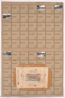
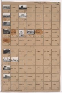
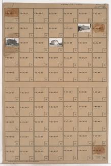
Tax Assessment Block Folder, Kansas City, MO, District 2, Block 224

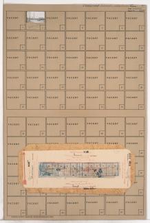
Folder contains a photograph of a Kansas City Gas Company building in the East Kansas addition, from Front Street south to 1st Street, and Campbell Street east to Gillis Street. The A.S.B. Bridge can be seen in the background of the image. Folder also contains plat map of the block.

Tax Assessment Block Folder, Kansas City, MO, District 2, Block 219

Folder contains photographs of businesses in an area of Northeast Kansas City, from Front Street south to Guinotte Avenue, and Tracy Avenue east to Lydia Avenue. The A.S.B. Bridge can be seen in the background of one of the images. Folder also includes plat map of the block.

Tax Assessment Block Folder, Kansas City, MO, District 2, Block 218

Folder contains photographs of industrial buildings in an area of Northeast Kansas City between the Missouri River and the rail lines, 1st Street, and Front Street, and spanning from the Hannibal Bridge to the A.S.B. Bridge, which can be seen in the background of one of the images.

Tax Assessment Block Folder, Kansas City, MO, District 2, Block 287

Folder contains photographs of businesses and other buildings in the Old Town addition, from Front Street south to 2nd Street, and Main Street east to Walnut Street. The Kansas City Southern Railroad office, at 2nd and Main, is among the buildings pictured. The A.S.B. Bridge can seen in the background of an image.