Kansas City Terminal Railway

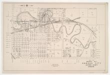
District No. 7 North Map, Kansas City, Jackson County, Missouri

Detail map of the northern half of District 7 of the 1940 tax assessment project. Map illustrates block numbers, appraised values, and plat boundaries, as well as railroad lines, streets, rivers, and other features. The map covers an area from Independence Avenue south to 31st Street, and from Topping Avenue east to Kansas City's 1940 eastern city limits.
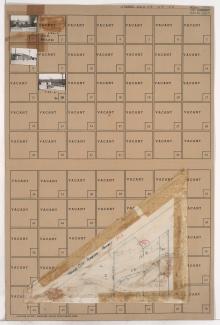
Tax Assessment Block Folder, Kansas City, MO, District 1, Block 72

Folder contains photographs of businesses in an area bound by Wilson Avenue, Winner Road, and Independence Avenue. Gulko Auto Wrecking, at 6200 Independence Avenue, and Home Coal & Lumber Company, at 5910 Independence Avenue, are among the buildings pictured. Folder also contains a plat map of the block showing the location of Goose Neck Creek.