District No. 40 North (Range 32, Township 48) Map, Jackson County, Missouri
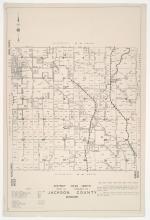
Detail map of the northern section of District 40 of the 1940 tax assessment project. Map illustrates block numbers, appraised values, and plat boundaries, as well as streets, rivers, railroads, and other features. The map covers an area of south-central Jackson County, Missouri, from roughly 59th Street south to Chipman Road, and from the District 20 boundary east to roughly Lee's Summit Road.