Tax Assessment Block Folder, Kansas City, MO, District 2, Block 85

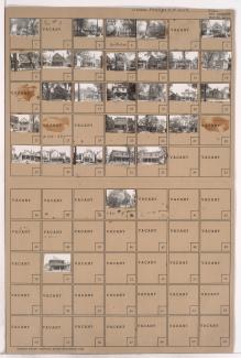
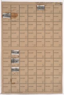
Folder contains photographs of residences in the McKinney Heights subdivision, from Scarritt Avenue south to Windsor Avenue, and Mersington Avenue east to Clinton Place.
Folder contains photographs of residences in the McKinney Heights subdivision, from Scarritt Avenue south to Windsor Avenue, and Mersington Avenue east to Clinton Place.
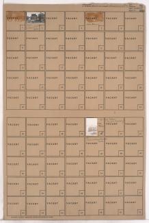
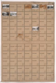
Folder contains photographs of residences in the Scaritt Point neighborhood, from Benton Boulevard east to Indiana Avenue, and Thompson Avenue south to Roberts Street. Folder also includes plat map of the block, which can be viewed below.

Map of block in the Pendleton Heights neighborhood, from Brownell Avenue south to Independence Avenue, and Woodland Avenue east to Maple Boulevard. Photographs of properties on the block can be viewed below.
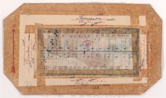
Map of block in the Scarritt Point neighborhood, from Benton Boulevard east to Indiana Avenue, and Thompson Avenue south to Roberts Street, containing information about tax assessment values of included properties, and illustrates lot numbers for the block. Photographs of properties on the block can be viewed below.
Folder contains photographs of a residence and the Saint John's Church rectory, at 1436 Indepdence Avenue, in the Pendleton Heights neighborhood, from Belvidere Avenue south to Independence Avenue, and Paseo Boulevard east to Highland Avenue.
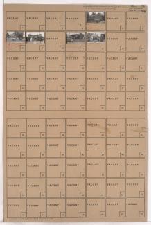
Folder contains photographs of residences in the Pendleton Heights neighborhood, from Belvidere Avenue south to Independence Avenue, and Lydia Avenue east to Paseo Boulevard.
Folder contains photographs of residences and other buildings in the Pendleton Heights neighborhood, from Pacific Street south to Belvidere Avenue, and Lydia Avenue east to Paseo Boulevard.

Folder contains a photograph of the Ralph Sanitarium Nurses Home, at 531 Highland Avenue, in the Pendleton Heights neighborhood, from Missouri Avenue south to Pacific Street, and Highland Avenue east to Dykington Avenue.
Folder contains photographs of residences and other buildings in the Pendleton Heights neighborhood, from Missouri Avenue and Pacific Street south to Independence Avenue, and Highland Avenue and Dykington Avenue east to Woodland Avenue. Photographed houses include the William Harvey Winants Residence, at 504 Woodland, the Fred C. Marsh residence, at 516 Woodland, and the Charles R. Russell residence, at 520 Woodland. Children's Mercy Hospital, at 1710 Independence Avenue, is among the buildings pictured.
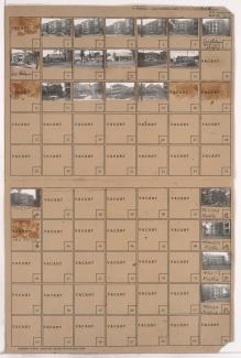
Folder contains photographs of residences, apartment buildings, and businesses in the Pendleton Heights neighborhood, from Brownell Avenue south to Independence Avenue, and Woodland Avenue east to Maple Boulevard. The Colonial Court Apartments are among the buildings pictured. Folder also contains plat map of the block, which can be viewed below.