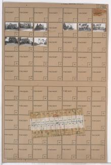
Folder contains photographs of residences in the Rockhill Gardens neighborhood, from 74th Street south to 74th Terrace, and Cherry Street east to Holmes Road. Folder also includes a plat map of the block.
Folder contains photographs of residences in the Rockhill Gardens neighborhood, from 74th Street south to 74th Terrace, and Cherry Street east to Holmes Road. Folder also includes a plat map of the block.
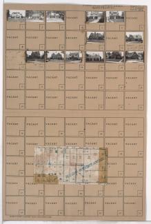
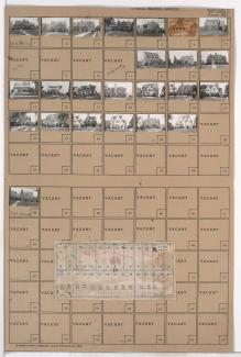
Folder contains photographs of residences in the Rockhill Gardens neighborhood, from 74th Terrace south to 75th Street, and Cherry Street east to Holmes Road. Folder also includes a plat map of the block.
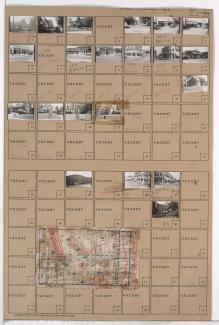
Folder contains photographs of residences in the Rockhill Gardens neighborhood, from 74th Street south to 74th Terrace, and Oak Street east to Cherry Street. Folder also includes a plat map of the block.

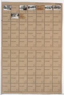
Folder contains photographs of residences in the Tower Homes neighborhood, from 74th Street south to 74th Terrace, and Grand Avenue east to Oak Street.

Folder contains photographs of residences in the Tower Homes neighborhood, from 74th Street south to 74th Terrace, and Wyandotte Street east to Main Street.
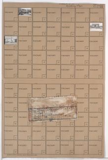
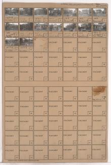
Folder contains photographs of residences, businesses, and other buildings in the Waldo neighborhood, from 74th Street south to 74th Terrace, and Wornall Road east to Wyandotte Street. Stewart Sand and Materials Company, at 74th Terrace and Wyandotte, is among the buildings pictured. Folder also includes a plat map of the block.

Folder contains photographs of residences in the Tower Homes neighborhood, from 74th Terrace south to 75th Street, and Wyandotte Street east to Main Street. St. Elizabeth's Catholic Church and School, at 75th and Main, are among the buildings pictured.

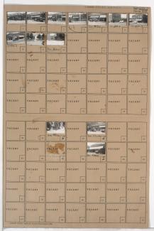
Folder contains photographs of residences in the Tower Homes neighborhood, from 74th Terrace south to 75th Street, and Grand Avenue east to Oak Street.
Folder contains photographs of residences and businesses in the Waldo neighborhood, from 74th Terrace south to 75th Street, and Wornall Road east to Wyandotte Street. The 8th Ward Democratic Club, at 212 West 75th, Kahle Grocery, at 214 West 75th, and Velvet Freeze Ice Cream, at 75th and Wornall, are among the buildings pictured. Folder also includes a plat map of the block.
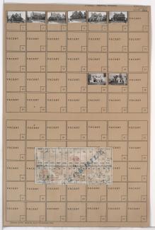
Folder contains photographs of residences in the Tower Homes neighborhood, from 74th Terrace south to 75th Street, and Oak Street east to Cherry Street. Folder also includes a plat map of the block.
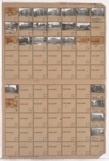
Folder contains photographs of businesses and other buildings in the Waldo neighborhood, from 74th Terrace south to 75th Street, and Washington Street east to Wornall Road. Wornall Hardware, at 7438 Wornall, and J. A. Peterson Variety Store, at 7432-7434 Wornall, are among the buildings pictured.
Folder contains photographs of residences, businesses, and other buildings in the Waldo neighborhood, from 74th Street south to 74th Terrace, and Washington Street east to Wornall Road. Waldo Poultry, at 7408 Wornall, and Roe-Walter Funeral Home, at 7406 Wornall, are among the buildings pictured.
Folder contains photographs of residences and apartment buildings in the Phillips Place addition, from Missouri Avenue south to Brownell Avenue, and Woodland Avenue east to Maple Boulevard. The Charles S. Lee Residence, at 1812 Brownell, is among the houses pictured.
Folder contains photographs of residences, apartment buildings, and businesses in the Pendleton Heights neighborhood, from Brownell Avenue south to Independence Avenue, and Woodland Avenue east to Maple Boulevard. The Colonial Court Apartments are among the buildings pictured. Folder also contains plat map of the block, which can be viewed below.

Map of block in the Pendleton Heights neighborhood, from Brownell Avenue south to Independence Avenue, and Woodland Avenue east to Maple Boulevard. Photographs of properties on the block can be viewed below.