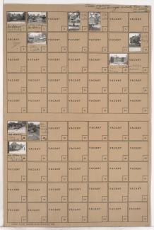
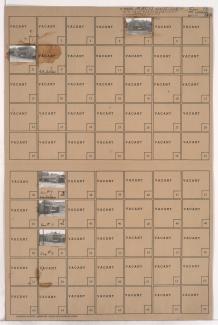
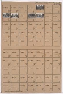
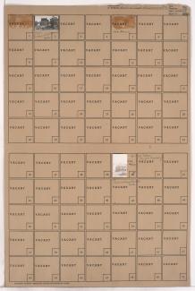
Folder contains photographs of residences and businesses in an area of Kansas City, from Belvidere Avenue south to Independence Avenue, and Tracy Avenue east to Lydia Avenue. Cain Memorial A.M.E. Church, at 595 Tracy, is among the buildings pictured.
Search
Folder contains photographs of residences and businesses in the Guinotte's Bluff addition, from Belvidere Avenue south to Independence Avenue, and Troost Avenue east to Forest Avenue. Numerous businesses along Independence Avenue are pictured.
Folder contains photographs of residences and businesses in the Guinotte's Bluff addition, from Pacific Street south to Belvidere Avenue, and Troost Avenue east to Forest Avenue. The Fidelity National Bank building can be seen in the background of an image.
Folder contains photographs of residences and businesses in an area of Kansas City, from Pacific Street south to Belvidere Avenue, and Tracy Avenue east to Lydia Avenue. Emerson (later Garrison) School, at 1309 Pacific, is among the buildings pictured.
Folder contains photographs of residences and other buildings in the Pendleton Heights neighborhood, from Pacific Street south to Belvidere Avenue, and Lydia Avenue east to Paseo Boulevard.
Folder contains photographs of residences in the Pendleton Heights neighborhood, from Belvidere Avenue south to Independence Avenue, and Lydia Avenue east to Paseo Boulevard.
Folder contains photographs of a residence and the Saint John's Church rectory, at 1436 Indepdence Avenue, in the Pendleton Heights neighborhood, from Belvidere Avenue south to Independence Avenue, and Paseo Boulevard east to Highland Avenue.
Folder contains photographs of residences in the Sheffield neighborhood, from Winner Road south to 9th Street, and Smith Avenue east to White Avenue.
Folder contains photographs of residences in the Sheffield neighborhood, from Winner Road south to 9th Street, and Bellaire Avenue east to Smith Avenue.