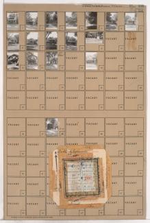
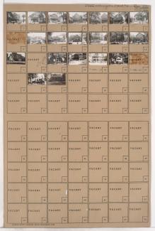
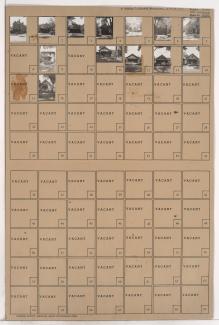
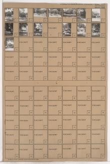
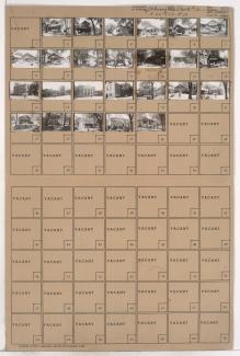
Folder contains photographs of residences, businesses, and a church in the South Indian Mound neighborhood, from St. John Avenue south to Budd Park Esplanade, and Chelsea Avenue east to Brighton Avenue. The Budd Park Christian Church, at 4925 St. John Avenue, is among the buildings pictured.
Search
Folder contains photographs of residences and other structures in the Washburn Place subdivision, from Budd Park Esplanade south to Smart Avenue, and Colorado Avenue east to Hardesty Avenue. Folder also contains a plat map of the block.
Folder contains photographs of residences, a church, and other buildings in the South Indian Mound neighborhood, from St. John Avenue south to Budd Park Esplanade (Anderson Avenue), and Van Brunt Boulevard east to Chelsea Avenue. The Fourth Church of Christ Scientist, at 133 Van Brunt Boulevard, is among the buildings pictured.
Folder contains photographs of residences in the Washburn Place subdivision, from Budd Park Esplanade south to Smart Avenue, and Denver Avenue east to Colorado Avenue.
Folder contains photographs of residences in the Washburn Place subdivision, from Budd Park Esplanade south to Smart Avenue, and Quincy Avenue east to Denver Avenue.
Folder contains photographs of residences and businesses in the Washburn Place subdivision, from Budd Park Esplanade south to Smart Avenue, and Brighton Avenue east to Quincy Avenue.
Folder contains photographs of residences and businesses in the North Indian Mound neighborhood, from Norledge Place south to Lyon Avenue, and Denver Avenue east to Hardesty Avenue. M & D Market, at 346 North Hardesty, is among the buildings pictured.
Folder contains photographs of residences in the North Indian Mound neighborhood, from Lyon Avenue south to Wilburn Court, and Denver Avenue east to Hardesty Avenue.