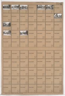
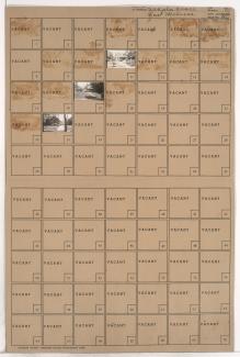
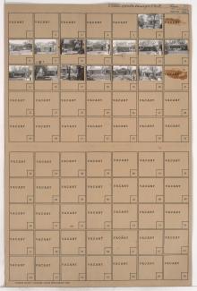
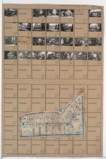
Folder contains photographs of residences and other buildings in the Greenway Fields neighborhood, from Greenway Terrace south to Meyer Boulevard, and Pennsylvania Avenue east to Wornall Road, including Greenway Circle. Wornall Road Baptist Church, at Wornall and Meyer, is among the buildings pictured. Folder also includes a plat map of the block.
Search
Folder contains photographs of residences in an area south of Kessler Park, from Gladstone Boulevard south to Sunrise Drive, and Cliff Drive Place east to Elmwood Avenue, and including Gladstone Circle.
Folder contains photographs of residences in the Cliff Drive Park subdivision, from Sunrise Drive south to Norledge Place, and Kensington Avenue east to Elmwood Avenue.
Folder contains photographs of residences in the Cliff Drive Park subdivision, from Sunrise Drive south to Norledge Place, and Jackson Avenue east to Kensington Avenue, and including a section of Cliff Drive Place.
Folder contains photographs of residences in the Cliff Drive Park subdivision, from Gladstone Boulevard south to Sunrise Drive, and Gladstone Place east to Cliff Drive Place.
Folder contains photographs of residences in the Scarritt Point neighborhood, from Sunrise Drive south to Norledge Avenue, and Mersington Avenue east to Jackson Avenue, including a segment of Clinton Place.
Folder contains photographs of residences in the Cliff Drive Park subdivision, from Gladstone Boulevard south to Sunrise Drive and east to Gladstone Place.
Folder contains photographs of residences in the Scarritt Point neighborhood, from Sunrise Drive south to Norledge Avenue, and Askew Avenue east to Mersington Avenue.
Folder contains photographs of residences in the North Burge Park subdivision, from Gladstone Boulevard south to Lakota Avenue (also known as Sunrise Drive), and Chelsea Avenue east to Brighton Avenue.
Folder contains photographs of residences and apartment buildings in the North Burge Park subdivision, from Gladstone Boulevard south to Lakota Avenue (also known as Sunrise Drive), and Van Brunt Boulevard east to Chelsea Avenue.
Folder contains photographs of residences in the North Burge Park subdivision, from Gladstone Boulevard south to Lakota Avenue (also known as Sunrise Drive), and Lawn Avenue east to Van Brunt Boulevard.
Folder contains photographs of residences in the North Burge Park subdivision, from Gladstone Boulevard south to Lakota Avenue (also known as Sunrise Drive), and Elmwood Avenue east to Lawn Avenue.
Folder contains photographs of residences in the North Indian Mound neighborhood, from Lakota Avenue (also known as Sunrise Drive) south to Scarritt Avenue, and Elmwood Avenue east to Lawn Ave.
Folder contains photographs of residences in the North Indian Mound neighborhood, from Lakota Avenue (also known as Sunrise Drive) south to Scarritt Avenue, and Van Brunt Boulevard east to Chelsea Avenue.
Folder contains photographs of residences in the North Indian Mound neighborhood, from Lakota Avenue (also known as Sunrise Drive) south to Scarritt Avenue, and Lawn Avenue east to Van Brunt Boulevard.
Folder contains photographs of residences in the North Indian Mound neighborhood, from Lakota Avenue (also known as Sunrise Drive) south to Scarritt Avenue, and Chelsea Avenue east to Brighton Avenue.