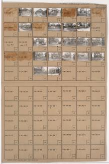
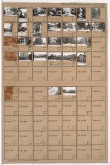
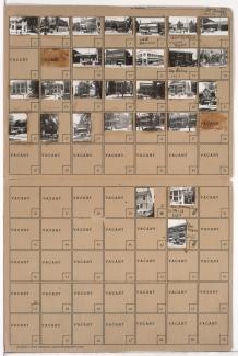
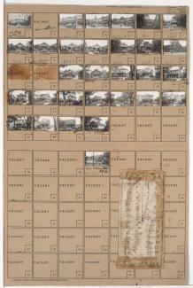
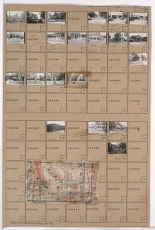
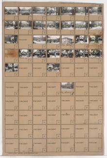
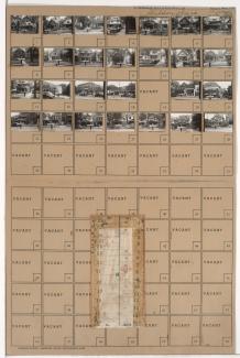
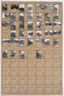
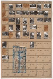
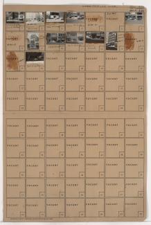
Folder contains photographs of businesses and other buildings in downtown Kansas City, from 12th Street south to 13th Street, and Grand Avenue east to McGee Steet. The Tower Theater and a portion of the Esquire Theater, on 12th Street, and the Craddock Uniform Company, on Grand Avenue, are among the buildings pictured.
Search
Folder contains photographs of residences and other buildings in the East Community Team neighborhood, from 26th Street south to 27th Street, and Spruce Avenue east to Kensington Avenue. The Phoenix Park M. E. Church, at 2601 Spruce, and East Side Vacuum Sweeper Company, at 4306 East 27th, are among the buildings pictured.
Folder contains photographs of residences, businesses, and apartment buildings in the Old Hyde Park neighborhood, from 38th Street south to 39th Street, and Broadway Boulevard east to Central Street. Berkeley Hotel, at 315 East 38th, is among the buildings pictured.
Folder contains photographs of residences, businesses, and apartment buildings in the Old Hyde Park neighborhood, from 38th Street south to 39th Street, and Baltimore Avenue east to Main Street. White Castle, at 3800 Main, the Madrid Theater, at 3810 Main, and President Shirt Shop, at 39th and Main, are among the buildings pictured.
Folder contains photographs of residences and businesses in the Oak Park Northwest neighborhood, from 36th Street south to 37th Street, and College Avenue east to Indiana Avenue. Maryland Grocery Company, at 37th and Indiana, is among the buildings pictured. Folder also includes a plat map of the block.
Folder contains photographs of residences, businesses, and apartment buildings in the Manheim Park neighborhood, from 46th Street south to 47th Street, and Troost Avenue east to Forest Avenue. Lewis Appliance Company, at 47th and Troost, and an A&P Supermarket, at 4625-4627 Troost, are among the buildings pictured. Folder also includes a plat map of the block.
Folder contains photographs of residences and businesses in the Waldo neighborhood, from 74th Terrace south to 75th Street, and Wornall Road east to Wyandotte Street. The 8th Ward Democratic Club, at 212 West 75th, Kahle Grocery, at 214 West 75th, and Velvet Freeze Ice Cream, at 75th and Wornall, are among the buildings pictured. Folder also includes a plat map of the block.
Folder contains photographs of residences and businesses in the Key Coalition neighborhood, from 30th Street south to 31st Street, and Woodland Avenue east to Michigan Avenue.
Folder contains photographs of residences and other buildings in the Key Coalition neighborhood, from 30th Street south to 31st Street, and Park Avenue east to Olive Street.
Folder contains photographs of residences, businesses, and other buildings in the Oak Park Northwest neighborhood, from 36th Street south to 37th Street, and Prospect Avenue east to Montgall Avenue. Herod's Kosher Market, at 3643 Prospect, is among the buildings pictured. Folder also includes a plat map of the block.
Folder contains photographs of residences, businesses, and apartment buildings in the Ivanhoe Northeast neighborhood, from 38th Street south to 39th Street, and Brooklyn Avenue east to Park Avenue. Max Epstein's Kosher Market, at 2214 East 39th, is among the buildings pictured.
Folder contains photographs of residences and businesses in the North Hyde Park neighborhood, from Linwood Boulevard south to 33rd Street, and Holmes Street east to Charlotte Street. Feinberg Kosher Sausage Company, at 709 East Linwood, and a Seventh Day Adventist Church, at Linwood and Charlotte, are among the buildings pictured. Folder also includes a plat map of the block.