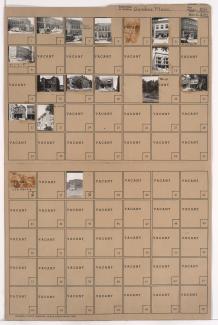
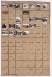
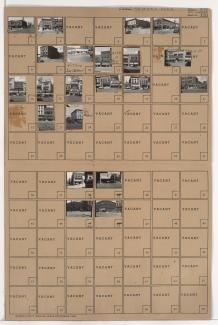
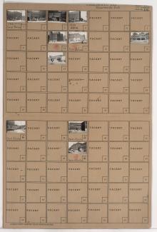
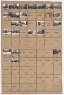
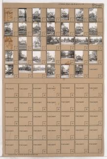
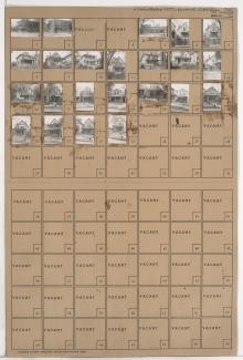
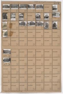
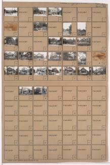
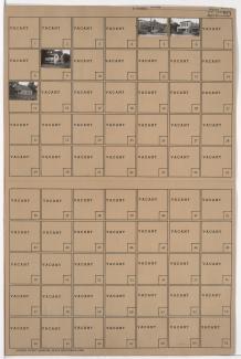
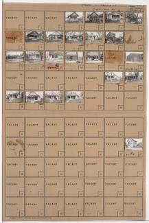
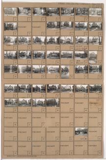
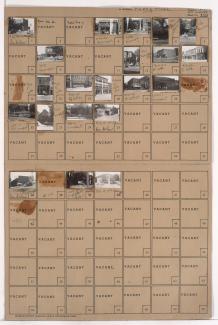
Folder contains photographs of residences, businesses, and other buildings in the Peery Place addition, from 11th Street south to 12th Street, and Campbell Street east to Harrison Street. Garnes Artificial Limb Corporation, at 904-906 East 12th, is among the buildings pictured.
Search
Folder contains photographs of residences, businesses, and other buildings in the Dundee Place addition, from 12th Street south to 13th Street, and Harrison Street east to Troost Avenue. Franklin Ice Cream Company, at 1207 Locust, is among the buildings pictured.
Folder contains photographs of apartment buildings, businesses, and other buildings in the Crossroads District, from 18th Street south to 19th Street, and Harrison Street east to Troost Avenue. Wyandotte Furniture Company, at 1808-1812 Troost, and Emerson Medicine Company are among the buildings pictured.
Folder contains photographs of businesses and other buildings in downtown Kansas City, from 13th Street south to 14th Street, and Grand Avenue east to McGee Street. The Adams Hotel and Missouri's Electric Store are among the buildings pictured.
Folder contains photographs of businesses and other buildings in the Crossroads District, from 17th Street south to 18th Street, and Baltimore Avenue east to Main Street. The Globe Storage and Transfer Company, at 1712 Main, and Muehlebach Brewing Company facilities, on 18th Street, are among the buildings pictured.
Folder contains photographs of businesses and other buildings in the Downtown East neighborhood, from 18th Street south to 19th Street, and Troost Avenue east to Forest Avenue. Missouri Salvage Bargain Store, at 1107 East 18th, and Bahr Furniture Company, at 1115-1117 East 18th, are among the buildings pictured.
Folder contains photographs of residences and businesses in the Belgravia subdivision, from Windsor Avenue south to St. John Avenue, and Jackson Avenue east to Kensington Avenue.
Folder contains photographs of residences, businesses, and other buildings in the Lykins neighborhood, from 12th Street south to 13th Street, and Askew Avenue east to Monroe Avenue.
Folder contains photographs of residences and other buildings in the Lykins neighborhood, from 11th Street south to 12th Street, and Norton Avenue east to Spruce Avenue.
Folder contains photographs of residences and businesses in the Lykins neighborhood, from 9th Street south to 10th Street, and Spruce Avenue east to Kensington Avenue. Sam's Market, at 4313 9th Terrace, is among the buildings pictured.
Folder contains photographs of residences and businesses in the Lykins neighborhood, from 9th Street south to 10th Street, and Bales Avenue east to Cleveland Avenue.
Folder contains photographs of businesses and residences in the East Community Team neighborhood, from 15th Street (later Truman Road) south to 16th Street, and Spruce Avenue east to Kensington Avenue.
Folder contains photographs of residences and businesses in the West Blue Valley neighborhood, from 15th Street (later Truman Road) south to 15th Terrace, and White Avenue east to Belmont Avenue.
Folder contains photographs of residences and businesses in the Leeds neighborhood, from 37th Street south to 38th Street, and Beacon Avenue east to Fremont Avenue.
Folder contains photographs of residences, businesses, and apartment buildings in the Washington Wheatley neighborhood, from 18th Street south to 21st Street, and Prospect Avenue east to Montgall Avenue.
Folder contains photographs of residences, businesses, and other buildings in the East Community Team neighborhood, from 23rd Street south to 24th Street, and Brighton Avenue east to Quincy Avenue. Hill's Market, at 5006 East 24th, is among the buildings pictured.
Folder contains photographs of residences and businesses in the East Community Team neighborhood, from 26th Street south to 27th Street, and Brighton Avenue east to Quincy Avenue. Hardin's Eggs and Poultry Company, at 500 East 27th, is among the buildings pictured.
Folder contains photographs of residences and businesses in the East Community Team neighborhood, from 26th Street south to 27th Street, and Myrtle Avenue east to Norton Avenue. Folder also includes a plat map of the block.
Folder contains photographs of residences and businesses in the Washington Wheatley neighborhood, from 26th Street south to 27th Street, and College Avenue east to Indiana Avenue. Folder also includes a plat map of the block.
Folder contains photographs of residences, businesses, and apartment buildings in the Santa Fe neighborhood, from 27th Street south to Lockridge Street, and Prospect Avenue east to Benton Boulevard. Folder also contains a plat map of the block, which can be viewed below.