
Folder contains photographs of residences in the Ivanhoe neighborhood, from Manheim Road south to 39th Street and west to Forest Avenue. The Victor Beutner House, at 1800 East 39th, is among the buildings pictured.
Folder contains photographs of residences in the Ivanhoe neighborhood, from Manheim Road south to 39th Street and west to Forest Avenue. The Victor Beutner House, at 1800 East 39th, is among the buildings pictured.

Folder contains a photograph of a building in the Blue Valley Park neighborhood, from 23rd Street south to 24th Street, and Topping Avenue east to Wheeling Avenue, including sections of Bellaire Avenue and White Avenue.

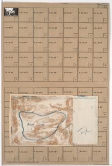
Folder contains photographs of a residence in the Blue Valley Park neighborhood adjacent to Bales Lake, from 23rd Street to south of 24th Street, and Wheeling Avenue east to Belmont Avenue. Folder also includes a plat map of the block.
Folder contains a photograph of a residence in the Blue Valley Park neighborhood adjacent to Bales Lake, south of 24th Street, and from Topping Avenue east to Wheeling Avenue. Folder also includes a plat map of the block.

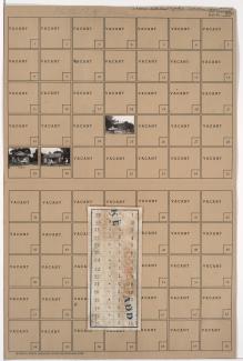
Folder contains photographs of residences in the Blue Valley Park neighborhood, north of 26th Terrace, and from Topping Avenue east to Belmont Avenue.

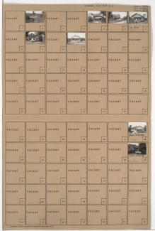
Folder contains photographs of residences and other buildings in the Blue Valley Park neighborhood, from 26th Terrace south to 27th Street, and Topping Avenue east to White Avenue. Folder also includes a plat map of the block.
Folder contains photographs of residences in the Blue Valley Park neighborhood, from 26th Terrace south to 27th Street, and White Avenue east to Belmont Avenue. Folder also includes a plat map of the block.
Folder contains photographs of residences and other buildings in the Blue Valley Park neighborhood, south of 23rd Street and east of Belmont Avenue, including a section of Beacon Avenue. Folder also contains plat map of the block, which can be viewed below.

Folder contains a photograph of a residence in the Blue Valley Park neighborhood, in an area adjacent to the intersection of Bennington Avenue and US Highway 40.

Folder contains photographs of residences in the Blue Valley Park neighborhood, from US Highway 40 and the Westport Independence Road south to 30th and 31st Streets, and east of Topping Avenue. Folder also includes a plat map of the block, which can be viewed below.
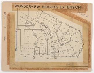
Map of block in the Blue Valley Park neighborhood, from US Highway 40 and the Westport Independence Road south to 30th and 31st Streets, and east of Topping Avenue, containing information about tax assessment values of included properties, and illustrating lot numbers for the block. Photographs of properties on the block can be viewed below.