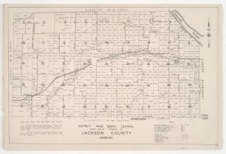
Small detail maps of platted areas A through F and H of the northern half of District 20 in Jackson County, Missouri. Maps illustrate block numbers, appraised values, and plat boundaries, as well as streets and railroads. Map A covers an area from Topping Avenue east to Eastern Avenue, and 47th Street south roughly to 52nd Street. Map B covers an area east of Bennington Avenue, adjacent to U.S. Highway 50 and Harris Road/55th Street. Map C covers a small area around the intersection of Topping and 63rd Street. Map D covers an area from 63rd Street south to 65th Street, and Kansas City's 1940 city limits east to Bennington Avenue. Map E covers an area from Bennington Avenue east to Cambridge and Bristol Avenues, and 65th Street and Blue Ridge Boulevard south to 69th Street. Map F covers an area from 77th and 79th Streets south to 83rd and 86th Streets, and from Woodland Avenue east to Prospect Avenue and Indiana Avenue, and includes the location of Fairyland Park. Map H covers a small area from 83rd Street south to 84th Street, and Sunset Drive east to Oldham Road.