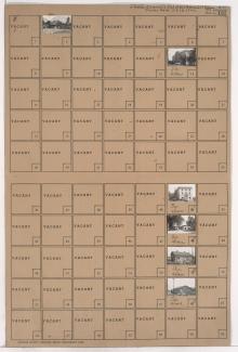
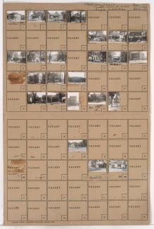
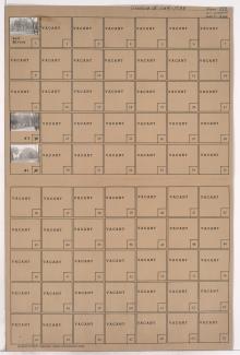
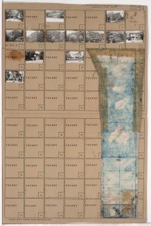
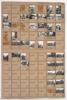
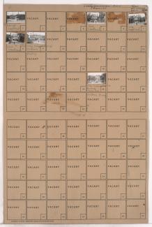
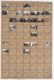
Folder contains photographs of residences, businesses, and other buildings in the Peery Place addition, from 10th Street south to 11th Street, and Campbell Street east to Harrison Street. The Wesley Hospital, at 1028-1030 Harrison, is among the buildings pictured.
Search
Folder contains photographs of buildings in the Wendell Phillips and Beacon Hill neighborhoods, from 25th Street south to 27th Street, and within Paseo Boulevard from east to west. Robinson Neurological Clinic, at 2625 Paseo, is among the buildings pictured.
Folder contains photographs of apartments and other buildings in the Mount Hope neighborhood, from 27th Street south to 29th Street, and Paseo Boulevard east to Vine Street, including sections of Troost Lake Drive and Flora Avenue.
Folder contains photographs of residences and other buildings in the Lykins neighborhood, from Independence Avenue south to 6th Street, and Indiana Avenue east to Monroe Avenue.
Folder contains photographs of residences and other buildings in the Sheffield neighborhood, from Independence Avenue south to 7th Street, and Fuller Avenue east to Bennington Avenue. Northeast Hospital, at 620 Bennington, is among the buildings pictured.
Folder contains photographs of St. Vincent's Hospital in the Washington Wheatley neighborhood, from 22nd Street south to 23rd Street, and Walrond Avenue east to College Avenue.
Folder contains photographs of residences and other buildings in the North Hyde Park neighborhood, from Linwood Boulevard south to 33rd Street, and Campbell Street east to Harrison Street. Thornton & Minor Hospital, at 911 East Linwood, and the Lucerne Apartment Hotel, at 921 East Linwood, are among the buildings pictured. Folder also includes a plat map of the block.
Folder contains photographs of residences, apartments, and other buildings in the Plaza/Westport neighborhood, from 43rd Street south to 45th Street, and Wornall Road east to Mill Creek Parkway (later J. C. Nichols Parkway). Folder also includes a plat map of the block.
Folder contains a photograph of Menorah Hospital in the Western 49-63 neighborhood, from Brush Creek and Volker Boulevard south to 50th Street, and Holmes Road east to Troost Avenue, including a section of Rockhill Road. Menorah Hospital is located at 4949 Rockhill Road. Folder also includes a plat map of the block.
Folder contains a photograph of Mercy Hospital, at 414 Highland Avenue, in an area of Northeast Kansas City from 3rd Street Terrace south to Pacific Street, and Paseo Boulevard east to Highland Avenue.
Folder contains photographs of residences and businesses in the Pendleton Heights neighborhood, from Elma Street south to Independence Avenue, and Prospect Boulevard east to Montgall Avenue. The Polyclinic Hospital (formerly the James R. Mackenzie Mansion), at 2624 Independence Avenue, is among the buildings pictured.
Folder contains photographs of residences and other buildings in the Pendleton Heights neighborhood, from Missouri Avenue and Pacific Street south to Independence Avenue, and Highland Avenue and Dykington Avenue east to Woodland Avenue. Photographed houses include the William Harvey Winants Residence, at 504 Woodland, the Fred C. Marsh residence, at 516 Woodland, and the Charles R. Russell residence, at 520 Woodland. Children's Mercy Hospital, at 1710 Independence Avenue, is among the buildings pictured.
Folder contains a photograph of the Ralph Sanitarium Nurses Home, at 531 Highland Avenue, in the Pendleton Heights neighborhood, from Missouri Avenue south to Pacific Street, and Highland Avenue east to Dykington Avenue.
Folder contains photographs of residences and businesses in the Hospital Hill neighborhood, from 22nd Street south to 23rd Street, and McCoy (later Kenwood) Avenue east to Holmes Street. The Research Hospital School of Nursing, at 2212-2216 Holmes, and the hospital's Diagnostic Department, at 622-624 East 23rd, are among the buildings pictured.
Folder contains photographs of buildings in the Hospital Hill neighborhood, from the rail lines south to 23rd Street, and Locust Street east to McCoy (later Kenwood) Avenue. Kansas City General Hospital No. 2 and its central heating plant and laundry facilities are among the buildings pictured.
Folder contains photographs of businesses and other buildings in the Hospital Hill neighborhood, from 23rd Street south to 24th Street, and McCoy Avenue east to Holmes Street. Research Hospital, on McCoy, is among the buildings pictured.
Folder contains photographs of Kansas City's General Hospital, in the Hospital Hill neighborhood, from 23rd Street south to 24th Street, and Locust Street east to McCoy Avenue.
Folder contains photographs of residences and other buildings in the Hospital Hill neighborhood, from 24th Street south to 24th Terrace, and from Locust Street east to Cherry Street. The General Hospital Nursing School, on 24th Street, is among the buildings pictured.
Folder contains photographs of residences and other buildings in the Longfellow neighborhood, from 25th Street south to 26th Street, and Locust Street east to Cherry Street. Vineyard Park Hospital is among the buildings pictured.
Folder contains photographs of residences, businesses, and apartment buildings adjacent to Penn Valley Park, from 30th Street south to 31st Street, and Wyandotte Street east to Baltimore Avenue. The Salem Home for the Aged, at 3008 Baltimore, and Trinity Lutheran Hospital, at 30th and Wyandotte, are among the buildings pictured.