
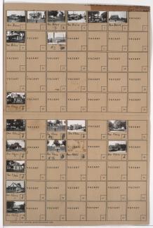
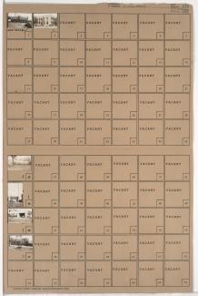
Folder contains photographs of residences, businesses, and other buildings in the Lykins neighborhood, from Independence Avenue south to 6th Street, and Denver Avenue east to Hardesty Avenue. White Front Market, at Independence and Hardesty,
Folder contains photographs of residences, businesses, and other buildings in the Lykins neighborhood, from Independence Avenue south to 6th Street, and Denver Avenue east to Hardesty Avenue. White Front Market, at Independence and Hardesty,

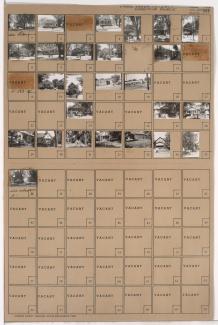
Folder contains photographs of residences and other buildings in the East Community Team neighborhood, from 15th Street (later Truman Road) south to 16th Street, and Lawn Avenue east to Lister Avenue.

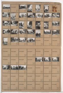
Folder contains photographs of residences, businesses, and other buildings in the Leeds neighborhood, from 35th Street south and the city limits west to the railroad tracks.
Folder contains photographs of residences, businesses, and other buildings in the Leeds neighborhood, from 35th Street south to 37th Street, and Bennington Avenue east to the Kansas City city limits.
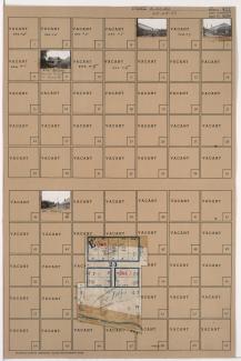
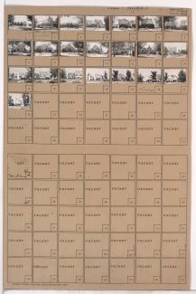
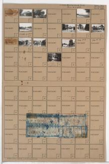
Folder contains photographs of greenhouses in the Leeds neighborhood, from 40th Street south to the Blue River, and Beacon Avenue east to Fremont Avenue. Folder also includes a plat map of the block.

First of two folders containing photographs of residences and other buildings in the Eastwood Hills neighborhood, south of 40th Street, and from Ewing Avenue east to the Kansas City city limits.

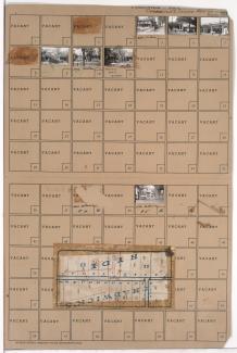
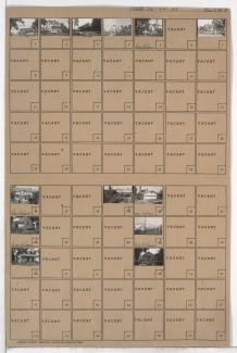
Folder contains photographs of residences and other buildings in the Palestine East neighborhood, from 37th Street south to 38th Street, and Myrtle Avenue east to Jackson Avenue. Folder also includes a plat map of the block.
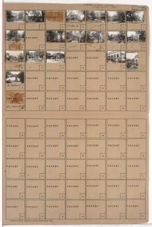
Folder contains photographs of residences and businesses in the Old Hyde Park neighborhood, from 34th Terrace south to Armour Boulevard, and Main Street east to Warwick Boulevard. The Rosery Flowers, on Main, is among the buildings pictured. Folder also includes a plat map of the block.
Folder contains photographs of residences, businesses, and apartment buildings in the Old Hyde Park neighborhood, from 36th Street south to 37th Street, and Broadway Boulevard east to Central Street. The Century Room, at 3607 Broadway, is among the buildings pictured.

Folder contains photographs of residences and other buildings in the Volker neighborhood, from 37th Street south to 38th Street, and Bell Street east to Genessee Street.

Folder contains photographs of the Kansas City Museum (formerly Corinthian Hall, home of Robert A. Long) at 3218 Gladstone Boulevard, and other buildings on the property, which extends from Norledge Place south to Scarritt Avenue, and Gladstone Boulevard east to Indiana Avenue. Additional pictured buildings include the property's greenhouse and carriage house.
Folder contains photographs of businesses and other buildings in the Country Club Plaza neighborhood, from 47th Street south to Ward Parkway, and Wyandotte Street east to Ward Parkway (later J. C. Nichols Parkway). The Postal Life and Casualty Company, at 4725 Wyandotte, is among the buildings pictured.

Folder contains photographs of residences and other buildings in the Plaza/Westport neighborhood, from 43rd Street south to 43rd Terrace, and Summit Street east to Jefferson Street.
Folder contains photographs of residences, businesses, and other buildings in the Volker neighborhood, from 42nd Street south to 43rd Street/Westport Road, and State Line Road east to Bell Street. A. Nelson Transfer Company, at 1802-1812 Westport Road, is among the buildings pictured.
Folder contains photographs of residences, businesses, and other buildings in the Holmes Park neighborhood, from 70th Street south to Gregory Road, and Holmes Road east to Troost Avenue, including a section of 70th Terrace. Folder also includes a plat map of the block, which can be viewed below.
Folder contains photographs of residences and businesses in the Tower Homes neighborhood, from Gregory Boulevard south to 72nd Street, and Grand Avenue east to McGee Street.
Folder contains photographs of residences and other buildings in the Waldo neighborhood, from 76th Street south to 77th Street, and Washington Street east to Wornall Road. Folder also includes a plat map of the block.

Folder contains photographs of residences and other buildings in the Ward Parkway neighborhood, from 75th Street south to 77th Street, and Jarboe Street east to Madison Avenue, including a section of Belleview Avenue. Folder also includes a plat map of the block, which can be viewed below.

Folder contains photographs of residences and other buildings in the Eastwood Hills West neighborhood, east of the 1940 Kansas City city limits, from Coal Mine Road southwest to U.S. Highway 50. Folder also includes two plat maps of the area, which can be viewed below.
Folder contains photographs of residences and other buildings in the Brown Estates neighborhood east of the 1940 Kansas City city limits, from 56th Street south to Byram Ford Road and west of Bennington Avenue.