District No. 60 South (Ranges 29 & 30, Township 47) Map, Jackson County, Missouri
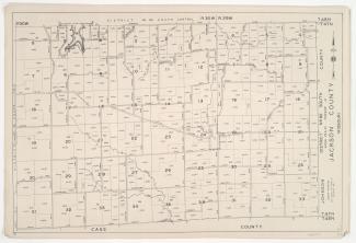
Detail maps of the southern section of District 60 of the 1940 tax assessment project. Map illustrates block numbers, appraised values, and plat boundaries, as well as streets and lakes. Map covers an area of southwestern Jackson County, from Hammond Road south to the Cass County line, and from Harris Road east to the Lafayette County line.
