
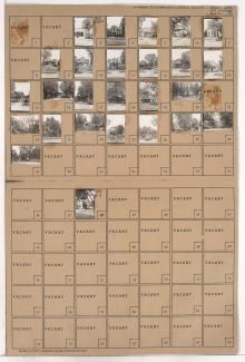
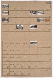
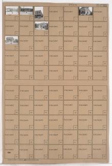
Folder contains photographs of residences in the East Community Team neighborhood, from 23rd Street south to 24th Street, and Mersington Avenue east to Myrtle Avenue, including a section of 23rd Terrace. Folder also includes a plat map of the block.
Folder contains photographs of residences in the East Community Team neighborhood, from 23rd Street south to 24th Street, and Mersington Avenue east to Myrtle Avenue, including a section of 23rd Terrace. Folder also includes a plat map of the block.

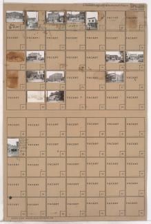
Folder contains photographs of residences, businesses, and other buildings in the East Community Team neighborhood, from 23rd Street south to 24th Street, and Cleveland Avenue east to Mersington Avenue, including a section of 23rd Terrace. Folder also includes a plat map of the block.
Folder contains photographs of National Bellas Hess facilities in an area of Northeast Kansas City, from Independence Avenue south to Winner Road, and Hardesty Avenue east to Topping Avenue.
Folder contains a photograph of Gulko Auto Wrecking Co., located in an area of Northeast Kansas City bordered by Wilson Avenue on the north and west, Winner Road on the south and east, Bennington Avenue on the east, and including a section of Beacon Avenue.

Folder contains photographs of buildings in the Lykins neighborhood, from 9th and 10th Streets south to Winner Road, and Brighton Avenue east to Hardesty Avenue, including a section of Denver Avenue.

Folder contains photographs of residences and other buildings in the Sheffield neighborhood, from 9th Street south to 10th Street, and Hardesty Avenue east to Oakley Avenue, including a section of Winner Road.
Folder contains photographs of residences and other buildings in the Sheffield neighborhood, from Winner Road south to 10th Street, and Oakley Avenue east to Topping Avenue.
Folder contains photographs of residences and businesses in the Sheffield neighborhood, from Wilson Avenue south to Winner Road, and Bennington Avenue east to Newton Avenue.
Folder contains photographs of businesses in the Sheffield addition, from Wilson Avenue south to Winner Road, and Newton Avenue east to Ewing Avenue. A photograph of the Manhattan Club features numerous beer and soft drink advertisements.
Folder contains photographs of businesses in the Sheffield addition, from Wilson Avenue south to Winner Road, and Ewing Avenue east to Cambridge Avenue. The Atlas Cafe, at 6817 Wilson Avenue, is among the buildings pictured.
Folder contains photographs of residences and businesses in the Sheffield neighborhood, from Winner Road south to Roberts Street, and Ewing Avenue east to Cambridge Avenue.
Folder contains photographs of residences and businesses in the Sheffield neighborhood, from Winner Road south to Roberts Street, and Newton Avenue east to Ewing Avenue. The Sheffield Post Office, at 410 Ewing, is among the buildings pictured.
Folder contains photographs of residences in the Sheffield neighborhood, from Winner Road south to Roberts Street, and Bennington Avenue east to Newton Avenue.

Folder contains photographs of residences in the Ridgeview subdivision, from Winner Road on the southeast to Roberts Street on the South and Bennington Avenue on the east.

Folder contains photographs of residences and businesses in the Ridgeview subdivision, from Roberts Street south to Independence Avenue, and Winner Road east to Fuller Avenue.

Folder contains photographs of residences in the Matthews & Hills addition, from Winner Road south to Thompson Avenue, and Manchester Avenue east to Smalley Avenue. Folder also includes plat map of the block.

Folder contains photographs of residences in the Sheffield neighborhood, from Winner Road south to 9th Street, and Smith Avenue east to White Avenue.

Folder contains photographs of residences in the Sheffield neighborhood, from Winner Road south to 7th Street and east to Beacon Avenue.

Folder contains a photograph of a of a Standard Oil service station in the Lykins neighborhood, from Winner Road north to Independence Avenue and west to White Avenue.

Folder contains photographs of residences in the Sheffield neighborhood, from Winner Road south to 8th Street, and White Avenue east to Wheeling Avenue.