
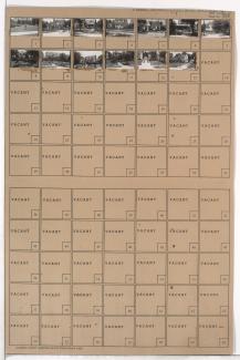
Folder contains photographs of residences and other buildings in the Tri-Blenheim neighborhood, from Meyer Boulevard south to 67th Street, and Wabash Avenue east to Prospect Avenue.
Folder contains photographs of residences and other buildings in the Tri-Blenheim neighborhood, from Meyer Boulevard south to 67th Street, and Wabash Avenue east to Prospect Avenue.

Folder contains photographs of residences in the Neighbors United for Action neighborhood, from 66th Terrace south to 67th Street, and Flora Avenue east to Woodland Avenue.
Folder contains photographs of residences in the Tri-Blenheim neighborhood, from Meyer Boulevard south to 67th Street, and Paseo Boulevard east to Brooklyn Avenue.

Folder contains photographs of residences in the Neighbors United for Action neighborhood, from Paseo Boulevard south to 67th Street and west to Woodland Avenue.

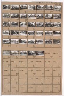
Folder contains photographs of residences in the Tri-Blenheim neighborhood, from Meyer Boulevard south to 67th Street, and Brooklyn Avenue east to Park Avenue.

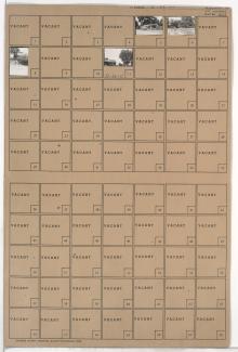
Folder contains photographs of residences in the Tri-Blenheim neighborhood, from Meyer Boulevard south to 67th Street, and Park Avenue east to Olive Avenue.

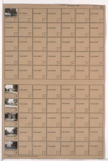
Folder contains photographs of residences in the Tri-Blenheim neighborhood, from Meyer Boulevard south to 67th Street, and Olive Avenue east to Wabash Avenue.
Folder contains photographs of buildings in and around the Forest Hill and Calvary Cemeteries, in the Neighbors United for Action Neighborhood.
Folder contains photographs of residences in the Tri-Blenheim neighborhood, from 67th Street south to 67th Terrace, and Paseo Boulevard east to Olive Avenue.

Folder contains photographs of residences in the Neighbors United for Action neighborhood, from 67th Street south to 68th Street, and Woodland Avenue east to Paseo Boulevard.

Map of block in the Holmes Park neighborhood, from 67th Street south to 68th Street, and Holmes Road east to Troost Avenue, containing information about tax assessment values of included properties, and illustrating lot numbers for the block. Photographs of properties on the block can be viewed below.

Folder contains photographs of residences in the Armour Hills neighborhood, from 67th Street south to 68th Street, and Main Street east to Grand Avenue. Folder also includes a plat map of the block.

Folder contains photographs of residences in the Armour Hills neighborhood, from 66th Terrace south to 67th Street, and Grand Avenue east to Oak Street.

Folder contains photographs of residences in the Armour Hills neighborhood, from 67th Street south to 68th Street, and Grand Avenue east to Oak Street.
Folder contains photographs of residences and other buildings in the Holmes Park neighborhood, from 65th Street south to 67th Street, and Holmes and Rockhill Roads east to Troost Avenue.

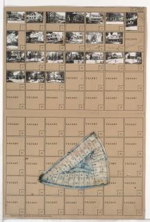
Folder contains a photograph of a building in the Holmes Park neighborhood, from 67th Street south to 68th Street, and Holmes Road east to Troost Avenue. A plat map of the block is affixed to the outside of the folder, and can be viewed below.
Folder contains photographs of residences in the Armour Hills neighborhood, from Edgevale Road south to 67th Street and Main Street east to Grand Avenue. Folder also includes a plat map of the block.

Folder contains photographs of residences in the Armour Hills neighborhood, from 66th Terrace south to 67th Street, and Brookside Road east to Linden Road. Folder also includes a plat map of the block.

Folder contains photographs of residences in the Armour Hills neighborhood, from 67th Street south to 67th Terrace, and Brookside Road east to Linden Road. Folder also includes a plat map of the block.

Folder contains photographs of residences in the Romanelli West neighborhood, from 64th Street south to 67th Street, and State Line Road east to Ward Parkway. The Bixby Residence, at 6505 State Line Road, is among the buildings pictured.