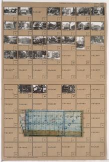
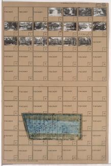
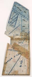
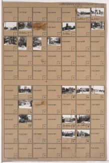
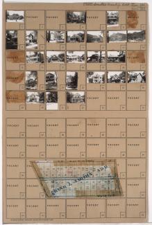
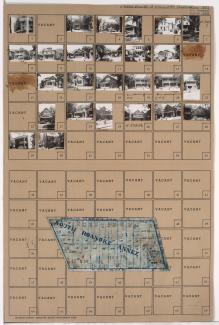
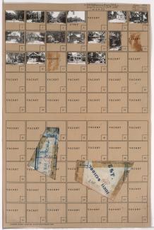
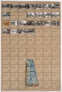
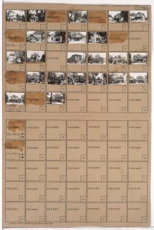
Folder contains photographs of residences, businesses, and apartment buildings in the Valentine neighborhood, from 38th Street south to 39th Street, and Summit Street (later Southwest Trafficway) east to Pennsylvania Avenue. Ritz Ice Cream, at 630 West 39th, is among the buildings pictured.
Search
Folder contains photographs of residences and other buildings in the Westport neighborhood, from 39th Street south to 39th Terrace, and Waddell Avenue (later Summit Street, later Southwest Trafficway) east to Pennsylvania Avenue. Adolph Hapke Jewelry Store, at 721 East 39th, and Janoe's Bakery, at 727 West 39th, are among the buildings pictured. Folder also includes a plat map of the block.
Folder contains photographs of residences in the Westport neighborhood, from 39th Terrace south to 40th Street, and Waddell Avenue (later Summit Street, later Southwest Trafficway) east to Pennsylvania Avenue. Folder also includes a plat map of the block.
Map of block in the Westport neighborhood, from 40th Street south to Westport Road, and Waddell Avenue east to Mill Street, containing information about tax assessment values of included properties, and illustrating lot numbers for the block. Photographs of properties on the block can be viewed below.
Folder contains photographs of residences and other buildings in the Westport neighborhood, from 40th Street south to Westport Road, and Waddell Avenue east to Mill Street. Kansas City Public Service Company building, at 40th and Waddell, and South Side Wood and Coal Company, at 536 Westport Road, are among the buildings pictured. Folder also includes a plat map of the block, which can be viewed below.
Folder contains photographs of residences in the Westport neighborhood, from 42nd Street south to Westport Road, and Clark Avenue east to Waddell Avenue.
Folder contains photographs of residences, businesses, and other buildings in the Volker neighborhood, from 39th Street south to 39th Terrace, and Clark Avenue east to Waddell Avenue. Roanoke Theatre, at 813 West 39th, is among the buildings pictured. Folder also includes a plat map of the block.
Folder contains photographs of residences and apartment buildings in the Volker neighborhood, from 39th Terrace south to 40th Street, and Clark Avenue east to Waddell Avenue. Folder also includes a plat map of the block.
Folder contains photographs of residences and other buildings in the Volker neighborhood, from 40th Terrace and 41st Street (later Mill Street) south to 42nd Street, and Clark Avenue east to Waddell Avenue. Allen School, at 706 West 42nd, is among the buildings pictured. Folder also includes a plat map of the block.
Folder contains photographs of residences in the Volker neighborhood, from 40th Street south to 41st Street, and Madison Avenue east to Waddell Avenue. Folder also includes a plat map of the block.
Folder contains photographs of residences and a church in the Pendleton Heights neighborhood, from 5th Street south to Elma Street, and Prospect Boulevard east to Witte Place.
Folder contains photographs of residences in the Pendleton Heights neighborhood, from 5th Street south to Elma Street, and Witte Place east to Montgall Avenue.