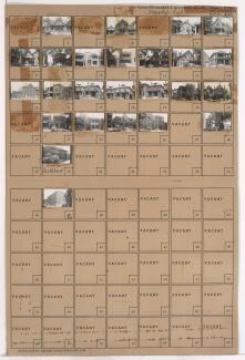
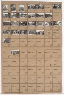
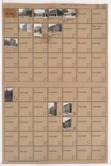
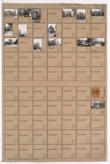
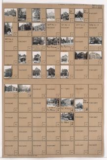
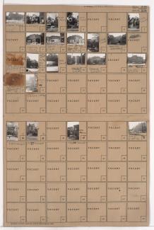
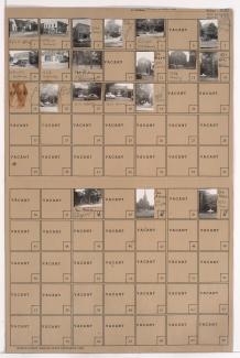
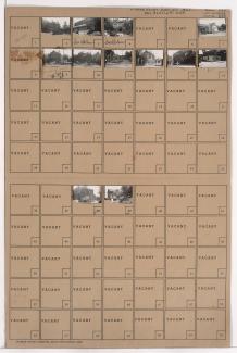
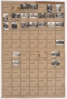
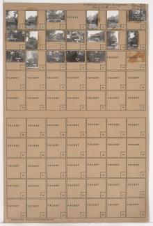
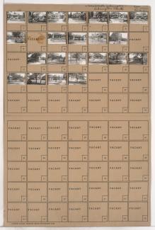
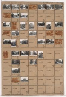
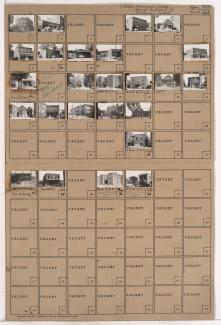
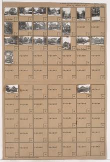
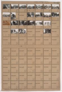
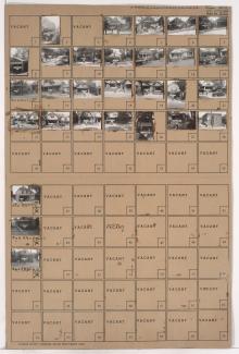
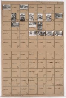
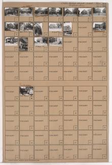
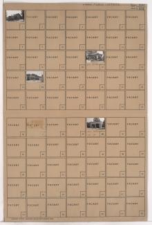
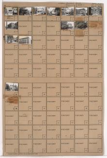
Folder contains photographs of houses, apartments, and other buildings in the Forgotten Homes neighborhood, from 12th Street south to 13th Street, and Garfield Avenue east to Brooklyn Avenue. The Metropolitan Spiritual Church of Christ, at 13th and Garfield, is among the buildings pictured.
Search
Folder contains photographs of residences and other buildings in the Forgotten Homes neighborhood, from 13th Street south to 14th Street, and Woodland Avenue east to Michigan Avenue. Pleasant Green Baptist Church, at 14th and Michigan, is among the buildings pictured.
Folder contains photographs of residences, businesses, and other buildings in the 18th and Vine District, from 14th Street south to 15th Street (later Truman Road), and Park Avenue east to Olive Street. Olivet Baptist Church, at 14th and Olive,
Folder contains photographs of residences and other buildings in the Peery Place addition, from 10th Street south to 11th Street, and Charlotte Street east to Campbell Street. Silver Laundry, on Campbell, Allen Chapel AME Church, on Charlotte, and Fire Department Number 5, at 11th and Campbell, are among the buildings pictured.
Folder contains photographs of residences, businesses, and other buildings in McGee's Addition, from 13th Street south to 14th Street, and Holmes Street east to Charlotte Street. Saint Mary's Episcopal Church, at 1307 Holmes, is among the buildings pictured.
Folder contains photographs of residences, businesses, and other buildings in the Dundee Place subdivision, from 13th Street south to 14th Street, and Campbell Street east to Harrison Street. St. Andrew's M.E. Church, at 14th and Campbell, is among the buildings pictured.
Folder contains photographs of residences, businesses, and other buildings in downtown Kansas City, from 14th Street south to 15th Street (later Truman Road), and Locust Street east to Cherry Street. The First English Lutheran Church, at 14th and Cherry, and Yelloway Garage, on Cherry, are among the buildings pictured.
Folder contains photographs of residences, businesses, and other buildings in McGee's Addition, from 15th Street (later Truman Road) south to 16th Street, and Cherry Street east to Holmes Street. Bethlehem Baptist Church, at 16th and Cherry, is among the buildings pictured.
Folder contains photographs of residences, businesses, and other buildings in downtown Kansas City, from 14th Street south to 15th Street (later Truman Road), and Broadway Boulevard east to Central Street. A Hellenic Orthodox Church, at 1423 Broadway, and the Hotel Touraine, at 1412-1420 Central, are among the buildings pictured.
Folder contains photographs of residences, businesses, and other buildings in the Downtown East neighborhood, from 14th Street south to 15th Street (later Truman Road), and Lydia Avenue east to Paseo Boulevard. Finance Storage Company, at 1406-1410 East 15th, is among the buildings pictured.
Folder contains photographs of residences and other buildings in the Wendell Phillips neighborhood, from 21st Street south to 22nd Street, and Park Avenue east to Olive Street. The Mt. Pleasant Baptist Church, at 2124 Olive, is among the buildings pictured.
Folder contains photographs of residences, businesses, and a church in the South Abington and Abington Park subdivisions, from Thompson Avenue south to Independence Avenue, and Elmwood Avenue east to Lawn Avenue. Oakley Methodist Church, at 4600 Independence Avenue, is among the buildings pictured.
Folder contains photographs of residences, businesses, and other buildings in the Downtown East neighborhood, from 17th Street south to 18th Street, and Lydia Avenue east to Paseo Boulevard. St. Paul's Presbyterian Church, at 1720 Paseo, is among the buildings pictured.
Folder contains photographs of residences, businesses, and other buildings in the Wendell Phillips neighborhood, from 18th Street south to 19th Street, and Woodland Avenue east to Euclid Avenue. Attucks School, on 19th Street, and Charles Bryant Barbecue, 1921 E. 18th Street, are among the buildings pictured.
Folder contains photographs of residences and businesses in the Wendell Phillips neighborhood, from 21st Street south to 22nd Street, and Wabash Avenue east to Prospect Avenue. Ward's Chapel of A.M.E. Church, at 22nd and Prospect, is among the buildings pictured.
Folder contains photographs of residences and other buildings in the Beacon Hill neighborhood, from 21st Street south to 22nd Street, and Troost Avenue east to Forest Avenue. The Progressive Baptist Church, at 2115 Troost, is among the buildings pictured.
Folder contains photographs of residences and other buildings in the Wendell Phillips neighborhood, from 23rd Street south to 24th Street, and Woodland Avenue east to Michigan Avenue. The Church of God, at 23rd and Woodland, is among the buildings pictured.
Folder contains photographs of residences, apartments, and other buildings in the Wendell Phillips neighborhood, from 24th Street south to 24th Terrace, and Woodland Avenue east to Michigan Avenue. Woodland Avenue Christian Church, at 24th and Woodland, is among the buildings pictured.
Folder contains photographs of residences and other buildings in the Wendell Phillips neighborhood, from 24th Terrace south to 25th Street, and Brooklyn Avenue east to Park Avenue. Bowers Methodist Church, at 25th and Park, and Regal Pharmacy, at 25th and Brooklyn, are among the buildings pictured.
Folder contains photographs of buildings in the Wendell Phillips neighborhood, from 25th Street south to 27th Street, and Paseo Boulevard east to Flora Avenue. Paseo Baptist Church, on 25th Street, is among the buildings pictured.