Tax Assessment Block Folder, Kansas City, MO, District 17, Block 40
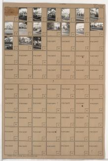
Folder contains photographs of residences in the Armour Hills neighborhood, from 66th Street south to 66th Terrace, and Brookside Road east to Linden Road.
Street Names
Folder contains photographs of residences in the Armour Hills neighborhood, from 66th Street south to 66th Terrace, and Brookside Road east to Linden Road.

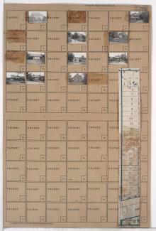
Folder contains photographs of residences in the Armour Hills neighborhood, from 66th Terrace south to 67th Street, and Brookside Road east to Linden Road. Folder also includes a plat map of the block.

Folder contains photographs of residences in the Armour Hills neighborhood, from Linden Road south to 66th Street and west to Brookside Road.

Folder contains photographs of residences in the Armour Hills neighborhood, from 67th Street south to 67th Terrace, and Brookside Road east to Linden Road. Folder also includes a plat map of the block.

Folder contains photographs of residences in the Armour Hills neighborhood, from 68th Terrace south to Edgevale Road and west to Brookside Road. Folder also includes a plat map of the block.

Folder contains photographs of residences in the Armour Hills neighborhood, from 67th Terrace south to 68th Street, and Brookside Road east to Edgevale Road.

Folder contains photographs of residences in the Armour Hills neighborhood, from 68th Street south to 68th Terrace, and Brookside Road east to Edgevale Road.

Folder contains photographs of residences in the Armour Hills neighborhood, from 69th Street south to 69th Terrace, and Brookside Road east to Main Street. Folder also includes a plat map of the block.

Folder contains photographs of residences in the Armour Hills neighborhood, from 69th Terrace south to 70th Street, and Brookside Road east to Main Street. Folder also includes a plat map of the block.

Folder contains photographs of residences in the Armour Hills neighborhood, from Dartmouth Road and 70th Street south to 70th Terrace, and Brookside Road east to Main Street. Folder also includes a plat map of the block.

Folder contains photographs of residences in the Armour Hills neighborhood, from 70th Terrace south to Gregory Boulevard, and Brookside Road east to Main Street. Folder also includes a plat map of the block.
Folder contains photographs of residences in the Tower Homes neighborhood, from 77th Street south to the 1940 Kansas City city limits, and Wornall Road east to Main Street, including a section of Brookside Road. older also includes a plat map of the block.