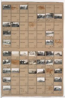
Folder contains photographs of residences, businesses, and other buildings in the Crossgates neighborhood, south of Hickman Mills Road and east of Hillcrest Road, in an area that later would fall in within the Kansas City and Grandview city limits.
Folder contains photographs of residences, businesses, and other buildings in the Crossgates neighborhood, south of Hickman Mills Road and east of Hillcrest Road, in an area that later would fall in within the Kansas City and Grandview city limits.
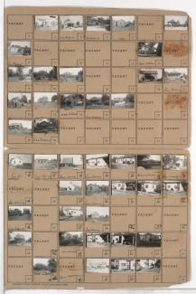
Folder contains photographs of residences and businesses in the Crossgates and Grandview area south of the 1940 Kansas City city limits, west of Hillcrest Road and adjacent to Martha Truman Road.

Folder contains photographs of residences in the Hillcrest neighborhood, south of the 1940 Kansas City city limits and east of Hillcrest Road.

Folder contains a photograph of a residence in the Hillcrest neighborhood, south of the 1940 Kansas City city limits and north of 83rd Street, and east of Hillcrest Road.

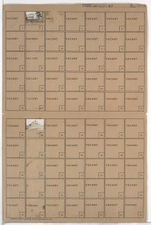
Folder contains photographs of residences and farm buildings in the Hillcrest neighborhood, from the 1940 Kansas City city limits south to 83rd Street, and from Goodman Road east to Hillcrest Road.
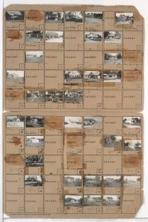
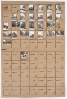
Folder contains photographs of residences, businesses, and other buildings in the Royal Oaks neighborhood, from 107th Street south to Hickman Mills Road, and Grandview Road east to Hillcrest Road.
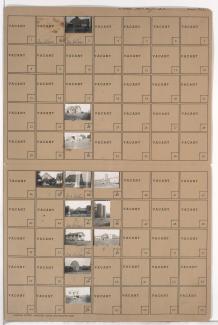
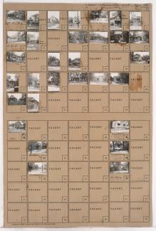
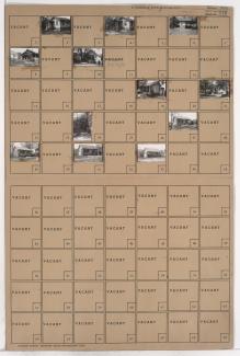
Folder contains photographs of residences and farm buildings in an area northeast of the 1940 Grandview city limits, east of Hillcrest Road and north of Highgrove Road.
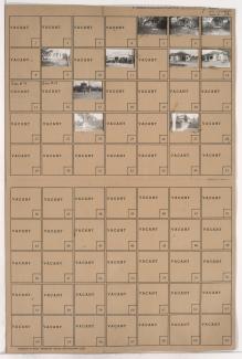
Folder contains photographs of residences and other buildings in an area northeast of the 1940 Grandview city limits, east of Hillcrest Road.

Folder contains photographs of residences in the Clifton Heights addition, from Gladstone Boulevard south to Saida Avenue, and Drury Avenue east to Oakley Avenue.

Folder contains photographs of residences and businesses in the Sheffield neighborhood, from 11th Street south to 12th Street, and Oakley Avenue east to Topping Avenue.

Folder contains photographs of residences and other buildings in the Sheffield neighborhood, from 9th Street south to 10th Street, and Hardesty Avenue east to Oakley Avenue, including a section of Winner Road.

Folder contains photographs of residences in the Sheffield neighborhood, from 10th Street south to 11th Street, and Hardesty Avenue east to Oakley Avenue, including a section of Winner Road.
Folder contains photographs of residences and other buildings in the Sheffield neighborhood, from Winner Road south to 10th Street, and Oakley Avenue east to Topping Avenue.
Folder contains photographs of residences and businesses in the Sheffield neighborhood, from 10th Street south to 11th Street, and Oakley Avenue east to Topping Avenue.

Folder contains photographs of residences in the Sheffield neighborhood, from 11th Street south to 12th Street, and Hardesty Avenue east to Oakley Avenue.

Folder contains photographs of residences and other buildings in the West Blue Valley neighborhood, from 12th Street south to 14th Street, and Oakley Avenue east to Lawndale Avenue.
Folder contains photographs of residences and other buildings in the West Blue Valley neighborhood, from 14th Street south to 15th Street (later Truman Road), and Oakley Avenue east to Lawndale Avenue.

Folder contains photographs of residences in the West Blue Valley neighborhood, from 12th Street south to 14th Street, and Drury Avenue east to Oakley Avenue.

Folder contains photographs of residences and businesses in the West Blue Valley neighborhood, from 14th Street south to 15th Street (later Truman Road), and Drury Avenue east to Oakley Avenue.
Folder contains photographs of residences in the Blue Valley neighborhood, from 17th Street south to 18th Street, and Hardesty Avenue east to Oakley Avenue.