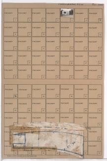
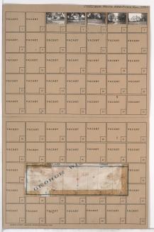
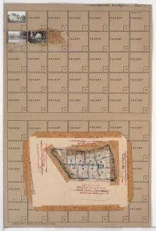
Folder contains a photograph of a business in the Santa Fe Hills neighborhood south of the 1940 Kansas City city limits, from 85th Street south to 85th Terrace and east of Holmes Road. Folder also includes a plat map of the block.
Folder contains a photograph of a business in the Santa Fe Hills neighborhood south of the 1940 Kansas City city limits, from 85th Street south to 85th Terrace and east of Holmes Road. Folder also includes a plat map of the block.

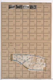
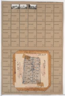
Folder contains photographs of residences in the Santa Fe Hills neighborhood south of the 1940 Kansas City city limits, from Rainbow Lane south to Sweeney Boulevard, and Hiawatha Road east to Daniel Boone Road. Folder also includes a plat map of the block.

Folder contains a photograph of a residence in the Santa Fe Hills neighborhood south of the 1940 Kansas City city limits, from Sweeney Boulevard south to Porte Cima Pas, and Maiden Lane east to Minnehaha Lane. Folder also includes a plat map of the block.

Folder contains photographs of residences in the Santa Fe Hills neighborhood south of the 1940 Kansas City city limits, from Pocahontas Lane south to Navajo Lane, and Hiawatha Road east to Daniel Boone Road. Folder also includes a plat map of the block.

Folder contains photographs of residences in the Santa Fe Hills neighborhood south of the 1940 Kansas City city limits, from Sweeney Boulevard south to Hollow Road, and Minnehaha Lane east to Grande Pas. Folder also includes a plat map of the block.
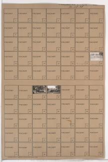
Folder contains photographs of residences in the Santa Fe Hills neighborhood south of the 1940 Kansas City city limits, from 85th Terrace south to 86th Street, and east of Holmes Road. Folder also includes a plat map of the block.
Folder contains photographs of residences in the Santa Fe Hills neighborhood south of the 1940 Kansas City city limits, from 86th Street south to 86th Terrace, and east of Holmes Road. Folder also includes a plat map of the block.
Folder contains photographs of residences in the Santa Fe Hills neighborhood south of the 1940 Kansas City city limits, from 85th Street south to 87th Street, and east of Sleepy Hollow Road.
Folder contains photographs of residences in the Santa Fe Hills neighborhood south of the 1940 Kansas City city limits, from 86th Terrace south to 87th Street, and east of Holmes Road. Folder also includes a plat map of the block.
Folder contains photographs of residences in the Santa Fe Hills neighborhood south of the 1940 Kansas City city limits, from Porte Cima Pas south to 89th Street, and Sleepy Hollow Road east to Iroquois Trail. Folder also includes a plat map of the block.
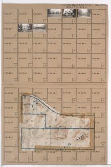
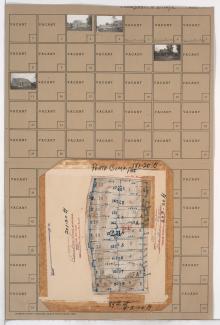
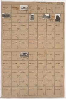
Folder contains photographs of residences and other buildings in the Santa Fe Hills neighborhood south of the 1940 Kansas City city limits, from Sweeney Boulevard south to 89th Street, and Wornall and Hiawatha Roads east to Daniel Boone Road, including Huron Circle. Boone School, at 8817 Wornall, is among the buildings pictured. Folder also includes a plat map of the block, which can be viewed below.
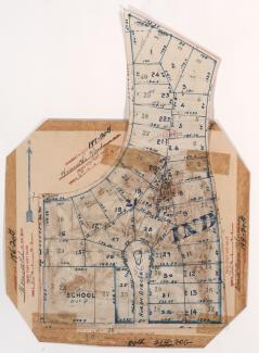
Map of block in the the Santa Fe Hills neighborhood south of the 1940 Kansas City city limits, from Sweeney Boulevard south to 89th Street, and Wornall and Hiawatha Roads east to Daniel Boone Road, including Huron Circle, containing information about tax assessment values of included properties, and illustrating lot numbers for the block. Photographs of properties on the block can be viewed below.
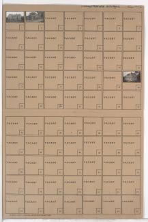
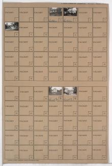
Folder contains photographs of residences in the Santa Fe Hills neighborhood south of the 1940 Kansas City city limits, from Sweeney Boulevard south to Porte Cima Pas and east to Rainbow Lane. Folder also includes a plat map of the block.
Folder contains photographs of residences, including several under construction, in the Santa Fe Hills neighborhood south of the 1940 Kansas City city limits, from Porte Cima Pas south to 89th Street, and Rainbow Lane east to Maiden Lane. Folder also includes a plat map of the block.
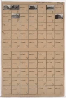
Folder contains photographs of residences and other buildings in the Santa Fe Hills neighborhood south of the 1940 Kansas City city limits, from 87th Street south to 89th Street, and Holmes Road east to Troost Avenue.

Folder contains photographs of businesses and other buildings in the Lykins addition, from 4th Street south to 5th Street, and Washington Street east to the Broadway Boulevard and Bank Street. English Brothers Machinery Company, at 5th and Bank, and K.C. Printing Ink Company, at 4th and Broadway, are among the buildings pictured.
Folder contains photographs of businesses and other buildings in the Lykins addition, from 4th Street south to 5th Street, and Bluff Street (later Beardsley Road) east to Washington Street. Central Chemical Company, at 510 West 4th, and G.G. Moore Boiler Works, at 518-520 West 5th, are among the buildings pictured.

Folder contains photographs of businesses and other buildings in the Cottage Place and East Cottage Place additions, from 5th Street south to 6th Street Trafficway, and Pennsylvania Avenue east to Broadway Boulevard, divided by Washington Street. A Salvation Army industrial building, at 6th and Broadway, and Interstate Tire Company, at 502 Broadway, are among the buildings pictured.
Folder contains photographs of businesses and other buildings in the Cottage Place addition, from 5th Street south to 6th Street Trafficway, and Bluff Street (later Beardsley Road) east to Pennsylvania Avenue.

Folder contains photographs of industrial buildings in the West Bottoms district, from the Missouri River south to Market Street, and the state line east to Mulberry Street.