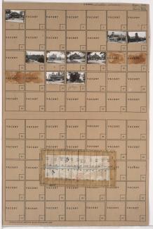
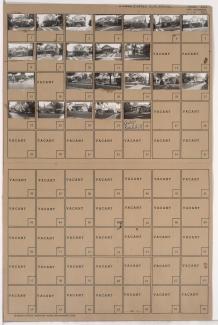
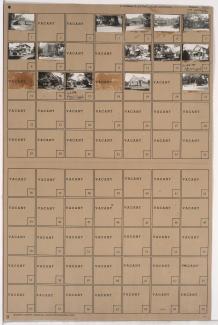
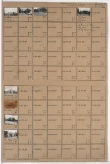
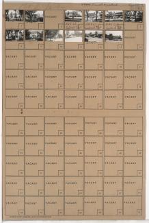
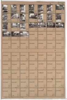
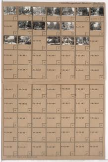
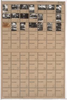
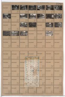
Folder contains photographs of residences, businesses, and other buildings in the Astor Place neighborhood, from 62nd Street south to 63rd Street, and Holmes Street east to Rockhill Road. Bruce School, at 624-626 East 63rd, is among the buildings pictured. Folder also includes a plat map of the block.
Search
Folder contains photographs of residences and businesses in the Astor Place neighborhood, from 62nd Street south to 63rd Street, and Oak Street east to Cherry Street. Crown Drug Company, at 400 East 63rd, is among the buildings pictured. Folder also includes a plat map of the block.
Folder contains photographs of residences and businesses in the Astor Place neighborhood, from 62nd Street south to 63rd Street, and Cherry Street east to Holmes Street.
Folder contains photographs of residences and businesses in the Western 49-63 neighborhood, from 62nd Street south to 63rd Street, and Rockhill Road east to Harrison Street.
Folder contains photographs of residences, businesses, and other buildings in the Western 49-63 neighborhood, from 62nd Street south to 63rd Street, and Harrison Street east to Troost Avenue. South Side Transfer and Storage, at 6244 Troost, is among the buildings pictured.
Folder contains photographs of residences in the Morningside neighborhood, from 62nd Street south to 63rd Street, and McGee Street east to Oak Street.
Folder contains photographs of residences in the Morningside neighborhood, from 62nd Street south to 63rd Street, and Morningside Drive east to McGee Street.
Folder contains photographs of businesses in the Brookside neighborhood, from 62nd Terrace south to 63rd Street, and Brookside Boulevard east to Main Street. The John S. Watkins Drugstore, at 6249-6251 Brookside Boulevard, is among the buildings pictured.
Folder contains photographs of residences in the Morningside neighborhood, from 62nd Terrace south to 63rd Street, and Main Street east to Morningside Drive.
Folder contains photographs of residences and businesses in the Brookside neighborhood, from 62nd Terrace south to 63rd Street, and Wornall Road east to Brookside Boulevard. A Kroger grocery store, at 338 West 63rd, is among the buildings pictured.
Folder contains photographs of residences in the Stratford Gardens neighborhood, from 62nd Street south to 63rd Street and east to Ward Parkway.
Folder contains photographs of residences in the Greenway Fields neighborhood, from 62nd Terrace south to 63rd Street, and Pennsylvania Avenue east to Wornall Road.
Folder contains photographs of residences in the Greenway Fields neighborhood, from 62nd Street south to 63rd Street, and Valley Road east to Pennsylvania Avenue.
Folder contains photographs of residences in the Country Club District, from 62nd Street south to 63rd Street, and Ward Parkway east to Summit Street.
Folder contains photographs of residences in the Greenway Fields neighborhood, from 62nd Street south to 63rd Street, and Summit Street east to Valley Road.
Folder contains photographs of residences in the Blue Hills neighborhood, from 62nd Street south to 63rd Street, and Olive Street east to Wabash Avenue.
First of two folders containing photographs of residences in the Citadel neighborhood, from 59th Street south to 63rd Street, and Blue Hills Road east to Park Avenue, including sections of Brooklyn Avenue and 62nd Street. A plat map for a portion of the area, northwest of 62nd Street and Park Avenue along Brooklyn Avenue, can be seen below. Plat map for Block 157 was incorrectly scanned with the folder.
Folder contains photographs of residences in the Citadel neighborhood, from 62nd Street south to 63rd Street, and Brooklyn Avenue east to Park Avenue. A plat map of the block was incorrectly scanned with Block 156 and is visible here: http://kc1940.org/districts/district-no-13-map-kansas-city-jackson-coun….
Folder contains photographs of residences in the Blue Hills neighborhood, from 62nd Street south to 63rd Street, and Park Avenue east to Olive Street. Folder also includes a plat map of the block.
Second of two folders containing photographs of residences in the Citadel neighborhood, from 59th Street south to 63rd Street, and Blue Hills Road east to Park Avenue, including sections of Brooklyn Avenue and 62nd Street. Folder also includes a plat map for a portion of the area, northwest of 62nd Street and Park Avenue along Brooklyn Avenue.