Folder contains a photograph of a residence in the Lea Manor neighborhood south of the 1940 Kansas City city limits, from County Road south to Pioneer Road (later 101st Street), and Woods Road east to Wornall Road.
Street Names
Folder contains a photograph of a residence in the Lea Manor neighborhood south of the 1940 Kansas City city limits, from County Road south to Pioneer Road (later 101st Street), and Woods Road east to Wornall Road.
Folder contains photographs of businesses and other buildings in the Country Club Plaza neighborhood, from 47th Street northeast to Wyandotte Avenue and northwest to Wornall Road. Martin's Cafeteria, on Wyandotte St., is one of the buildings pictured.
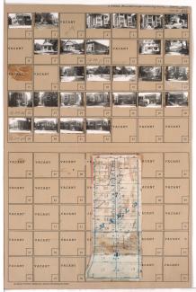
Folder contains photographs of residences, apartments, and other buildings in the South Plaza neighborhood, from 51st Street south to 52nd Street, and Wyandotte Street east to Baltimore Avenue. Folder also includes a plat map of the block.
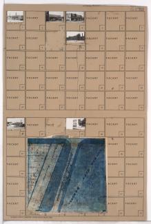
Folder contains photographs of residences, businesses, and other buildings in the Brookside neighborhood, from 63rd Street south to Meyer Boulevard, and Wornall Road east to Wyandotte Avenue (later Brookside Plaza), including a section of Brookside Boulevard. Mrs. Stover's Bungalow Candies, at 6306 Brookside Plaza, Border Star School, at 6307-6321 Wornall, and the Country Club Oasis, at 6310 Brookside Plaza, are among the buildings pictured. Folder also includes a plat map of the block.
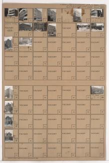
Folder contains photographs of businesses and other buildings in downtown Kansas City, from 7th Street south to 8th Street, and Wyandotte Avenue east to Baltimore Avenue. The Rex Hotel, at 8th and Baltimore, is among the buildings pictured.
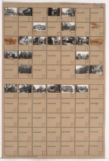
Folder contains photographs of residences and apartment buildings adjacent to Penn Valley Park, from 29th Street south to 30th Street, and Wyandotte Avenue east to Baltimore Avenue.