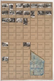
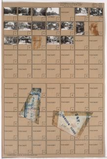
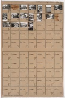
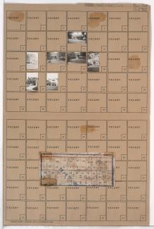
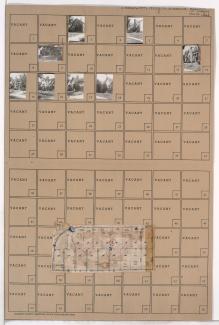
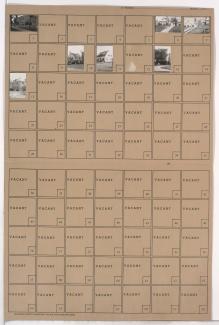
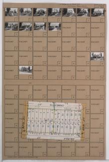
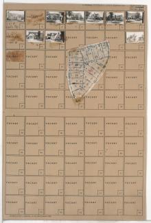
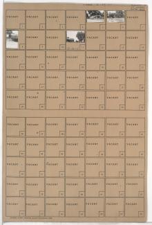
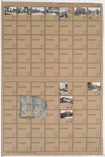
Folder contains photographs of businesses and other buildings in the Westport neighborhood, from 40th Terrace south to Westport Road, and Pennsylvania Avenue east to Washington Street. The Bel-Art Cafe, at 4038 Broadway, Stegner and Stubbs Restaurant, at 406 Westport Road, and K.C. Curtain & Linen Company, at 400 Westport Road, are among the buildings pictured. Folder also includes a plat map of the block.
Search
Folder contains photographs of residences, businesses, and other buildings in the Westport neighborhood, from 40th Street south to 40th Terrace, and Pennsylvania Avenue east to Washington Street. Fire Station No. 19, at 4012 Washington, is among the buildings pictured. Folder also includes a plat map of the block.
Folder contains photographs of residences and other buildings in the Volker neighborhood, from 40th Terrace and 41st Street (later Mill Street) south to 42nd Street, and Clark Avenue east to Waddell Avenue. Allen School, at 706 West 42nd, is among the buildings pictured. Folder also includes a plat map of the block.
Folder contains photographs of residences and other buildings in the Volker neighborhood, from 40th Street south to 40th Terrace, and Clark Avenue east to Madison Avenue.
Folder contains a photograph of Menorah Hospital in the Western 49-63 neighborhood, from Brush Creek and Volker Boulevard south to 50th Street, and Holmes Road east to Troost Avenue, including a section of Rockhill Road. Menorah Hospital is located at 4949 Rockhill Road. Folder also includes a plat map of the block.
Folder contains photographs of residences and businesses in the Greenway Fields neighborhood, from 63rd Street south to 63rd Terrace, and Holmes Road east to Rockhill Road. Folder also includes a plat map of the block.
Folder contains photographs of residences in the Greenway Fields neighborhood, from 63rd Terrace south to Meyer Boulevard, and Holmes Road east to Rockhill Road. Folder also includes a plat map of the block.
Folder contains a photograph of a residence in the Oak Meyer Gardens neighborhood, from 63rd Street south to 63rd Terrace, and Cherry Street east to Holmes Road. Folder also includes a plat map of the block.
Folder contains photographs of residences in the Oak Meyer Gardens neighborhood, from 63rd Terrace south to Meyer Boulevard, and Cherry Street east to Holmes Road. Folder also includes a plat map of the block.
Folder contains photographs of residences in the Oak Meyer Gardens neighborhood, from Meyer Boulevard south to 64th Terrace, and Cherry Street east to Holmes Road.
Folder contains photographs of residences in the Oak Meyer Gardens neighborhood, from 64th Terrace south to 65th Street, and Cherry Street east to Holmes Road.
Folder contains photographs of residences and other buildings in the Holmes Park neighborhood, from Meyer Boulevard south to 65th Street, and Holmes Road east to Charlotte Street. Saint Peter's Catholic Church and School, at Meyer and Charlotte, is among the buildings pictured.
Folder contains photographs of residences in the Holmes Park neighborhood, from 65th Street south to 66th Street, and Holmes Road south to Charlotte Street. Folder also includes a plat map of the block.
Map of block in the Holmes Park neighborhood, from 67th Street south to 68th Street, and Holmes Road east to Troost Avenue, containing information about tax assessment values of included properties, and illustrating lot numbers for the block. Photographs of properties on the block can be viewed below.
Folder contains photographs of residences in the Oak Meyer Gardens neighborhood, from 66th Terrace south to Rockhill Road and Kenwood Avenue east to Holmes Road. Folder also includes a plat map of the block.
Folder contains photographs of residences and other buildings in the Holmes Park neighborhood, from 65th Street south to 67th Street, and Holmes and Rockhill Roads east to Troost Avenue.
Folder contains a photograph of a building in the Holmes Park neighborhood, from 67th Street south to 68th Street, and Holmes Road east to Troost Avenue. A plat map of the block is affixed to the outside of the folder, and can be viewed below.
Folder contains photographs of residences in the Oak Meyer Gardens neighborhood, from Rockhill Road south to 69th Street, and Cherry Street east to Holmes Road, including a section of Kenwood Avenue.
Map of block in the Oak Meyer Gardens neighborhood, from Rockhill Road south to 69th Street, and Cherry Street east to Holmes Road, including a section of Kenwood Avenue, containing information about tax assessment values of included properties, and illustrating lot numbers for the block. Photographs of properties on the block can be viewed below.
Folder contains photographs of residences in the Holmes Park neighborhood, from 69th Street south to 69th Terrace, and Cherry Street east to Holmes Road. Folder also includes a plat map of the block.