
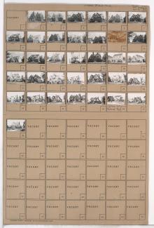
Folder contains photographs of residences in the Tower Homes neighborhood, from 72nd Terrace south to 73rd Street, and Grand Avenue east to Oak Street.
Folder contains photographs of residences in the Tower Homes neighborhood, from 72nd Terrace south to 73rd Street, and Grand Avenue east to Oak Street.
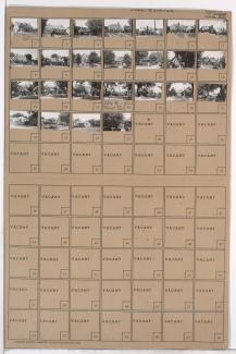
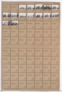
Folder contains photographs of residences in the Tower Homes neighborhood, from 72nd Street south to 72nd Terrace, and Grand Avenue east to Oak Street.
Folder contains photographs of residences in the Rockhill Gardens neighborhood, from 72nd Street south to 72nd Terrace, and Cherry Street east to Holmes Road. Folder also includes a plat map of the block.
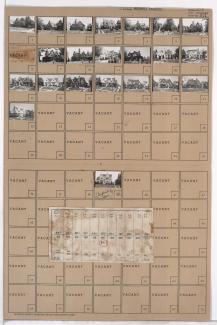
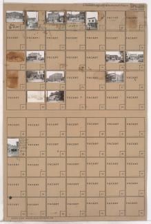
Folder contains photographs of residences in the Tower Homes neighborhood, from 72nd Terrace south to 73rd Street, and Cherry Street east to Holmes Road. Folder also includes a plat map of the block.
Folder contains photographs of residences in the Rockhill Gardens neighborhood, from 72nd Street south to 72nd Terrace, and Oak Street east to Cherry Street. Folder also includes a plat map of the block.
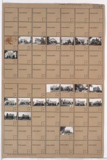
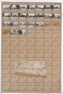
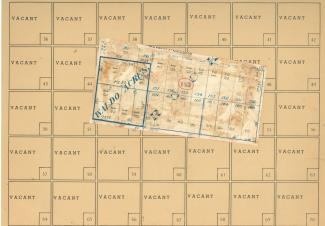
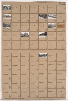
Folder contains photographs of residences in the Tower Homes neighborhood, from 72nd Street and Charlotte Street south to 72nd Terrace and 73rd Street, and Holmes Road east to Troost Avenue. Folder also includes a plat map of the block which can be viewed below.

Map of block in the Tower Homes neighborhood, from 72nd Street and Charlotte Street south to 72nd Terrace and 73rd Street, and Holmes Road east to Troost Avenue, containing information about tax assessment values of included properties, and illustrating lot numbers for the block. Photographs of properties on the block can be viewed below.

Folder contains photographs of residences in the Tower Homes neighborhood, from 72nd Terrace south to 73rd Street and east to Troost Avenue. Folder also includes a plat map of the block.
Folder contains photographs of residences in the Romanelli West neighborhood, from 72nd Street south to 72nd Terrace, and State Line Road east to Terrace Street.
Folder contains photographs of residences in the Romanelli West neighborhood, from 72nd Terrace south to 73rd Street, and State Line Road east to Terrace Street.
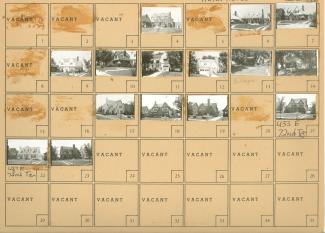
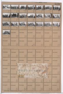
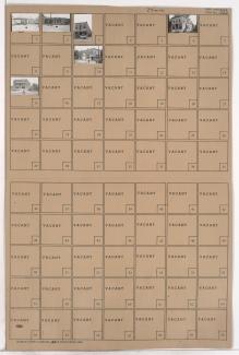
Folder contains photographs of residences in the Rockhill Gardens neighborhood, from 72nd Terrace south to 73rd Street, and Oak Street east to Cherry Street. Folder also includes a plat map of the block, which can be viewed below.
Map of block in the Rockhill Gardens neighborhood, from 72nd Terrace south to 73rd Street, and Oak Street east to Cherry Street, containing information about tax assessment values of included properties, and illustrating lot numbers for the block. Photographs of properties on the block can be viewed below.
Folder contains photographs of National Bellas Hess facilities in an area of Northeast Kansas City, from Independence Avenue south to Winner Road, and Hardesty Avenue east to Topping Avenue.
Folder contains a photograph of Gulko Auto Wrecking Co., located in an area of Northeast Kansas City bordered by Wilson Avenue on the north and west, Winner Road on the south and east, Bennington Avenue on the east, and including a section of Beacon Avenue.

Folder contains photographs of buildings in the Lykins neighborhood, from 9th and 10th Streets south to Winner Road, and Brighton Avenue east to Hardesty Avenue, including a section of Denver Avenue.

Folder contains photographs of residences and other buildings in the Sheffield neighborhood, from 9th Street south to 10th Street, and Hardesty Avenue east to Oakley Avenue, including a section of Winner Road.
Folder contains photographs of residences and other buildings in the Sheffield neighborhood, from Winner Road south to 10th Street, and Oakley Avenue east to Topping Avenue.
Folder contains photographs of residences and businesses in the Sheffield neighborhood, from Wilson Avenue south to Winner Road, and Bennington Avenue east to Newton Avenue.
Folder contains photographs of businesses in the Sheffield addition, from Wilson Avenue south to Winner Road, and Newton Avenue east to Ewing Avenue. A photograph of the Manhattan Club features numerous beer and soft drink advertisements.
Folder contains photographs of businesses in the Sheffield addition, from Wilson Avenue south to Winner Road, and Ewing Avenue east to Cambridge Avenue. The Atlas Cafe, at 6817 Wilson Avenue, is among the buildings pictured.