
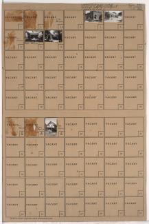
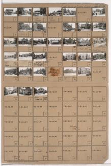
Folder contains photographs of residences in the West Side neighborhood, from 23rd Street Trafficway south to 23rd Terrace, and Allen Avenue east to Fairmount Avenue.
Folder contains photographs of residences in the West Side neighborhood, from 23rd Street Trafficway south to 23rd Terrace, and Allen Avenue east to Fairmount Avenue.

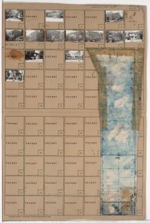
Folder contains photographs of residences in the West Side neighborhood, from 23rd Terrace south to Allen Avenue, and Allen Avenue east to Fairmount Avenue.
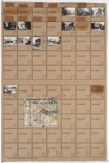
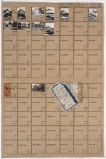
Folder contains photographs of residences and other buildings in the Westport neighborhood, from Lawrence Avenue south to Filmore Street (later 41st Street), and Mill Creek Parkway (later Broadway) east to Central Street. Kallaian Rose Rug Company, at 4163 Mill Creek, is among the buildings pictured.
Folder contains photographs of residences, businesses, and other buildings in the Westport neighborhood, from Westport Road south to Archibald Avenue, and Mill Creek Parkway (later Broadway) east to Central Street. Westport Avenue Bank, at Westport and Mill Creek Parkway, and Broadway Hardware Company, at 311 Westport, are among the buildings pictured. Folder also includes a plat map of the block.

Folder contains photographs of residences and apartment buildings in the Westport neighborhood, from Archibald Avenue south to Lawrence Avenue, and Mill Creek Parkway (later Broadway) east to Central Street.
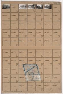
Folder contains photographs of businesses and other buildings in the Westport neighborhood, from Westport Road south to Archibald Avenue, and Pennsylvania Avenue east to Mill Creek Parkway (later Broadway). Jolly Inn Cafe, at 431 Westport, and Plaza Motors, at 4114-4124 Mill Creek Parkway, are among the buildings pictured. Folder also includes a plat map of the block.
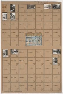
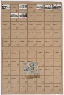
Folder contains photographs of residences, businesses, and other buildings in the Westport neighborhood, from Archibald Avenue south to 42nd Street, and Pennsylvania Avenue east to Mill Creek Parkway (later Broadway). Maxon Transfer and Delivery, at 42nd and Pennsylvania, is among the buildings pictured. Folder also includes a plat map of the block.
Folder contains photographs of residences, businesses, and other buildings in the Plaza/Westport neighborhood, from 43rd Street south to 47th Street, and Mill Creek Parkway (later J. C. Nichols Parkway) east to Main Street. Roy's Restaurant, at 4500 Main, and the Blue Room, at 4536 Main, are among the buildings pictured.
Folder contains photographs of residences, apartments, and other buildings in the Plaza/Westport neighborhood, from 43rd Street south to 45th Street, and Wornall Road east to Mill Creek Parkway (later J. C. Nichols Parkway). Folder also includes a plat map of the block.
Folder contains photographs of residences, businesses, and other buildings in the Plaza/Westport neighborhood, from 42nd Street south to 43rd Street, and Wornall Road east to Mill Creek Parkway (later Broadway), including a section of Pennsylvania Avenue. R. L. Sweet Lumber Company, at 200 West 43rd, Plaza Laundry, at 501 West 42nd, and the Penn School, at 4237 Pennsylvania, are among the buildings pictured. Folder also includes a plat map of the block.
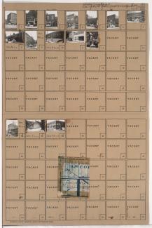
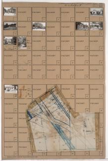
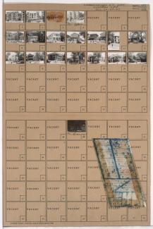
Folder contains photographs of residences and other buildings in the Westport neighborhood, from Filmore Street (later 41st Street) south to 42nd Street (later Vietnam Veterans Memorial Drive), and Mill Creek Parkway (later Broadway) east to Central Street and Baltimore Avenue. A Toddle House restaurant, at 42nd and Mill Creek, is among the buildings pictured. Folder also includes a plat map of the block.
Folder contains photographs of residences and apartment buildings, from 46th Street south to 46th Terrace, and Wornall Road east to Mill Creek Parkway (later J. C. Nichols Parkway). Park Line Apartment Hotel, at 4600 Mill Creek Parkway, is among the buildings pictured. Folder also includes a plat map of the block.
Folder contains photographs of businesses and other buildings in the Country Club Plaza neighborhood, from 46th Terrace south to 47th Street, and Wyandotte Street east to Mill Creek Parkway (later J. C. Nichols Parkway). The Mill Creek Building, at 4638 Mill Creek Parkway, and Tower Building, at 114 West 47th, are among the buildings pictured. Folder also includes a plat map of the block.
Folder contains photographs of residences, apartments, and other buildings in the Plaza/Westport neighborhood, from 45th Street south to 46th Street, and Wornall Road east to Mill Creek Parkway (later J. C. Nichols Parkway). Folder also includes a plat map of the block.