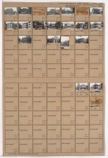
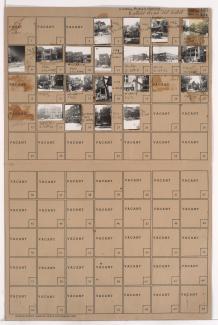
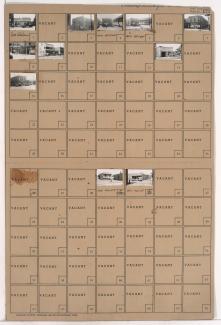
Folder contains photographs of businesses, apartments, and other buildings in the Independence Plaza neighborhood, from 12th Street south to 13th Street, Olive Street east to Park Avenue.
Folder contains photographs of businesses, apartments, and other buildings in the Independence Plaza neighborhood, from 12th Street south to 13th Street, Olive Street east to Park Avenue.

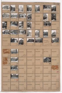
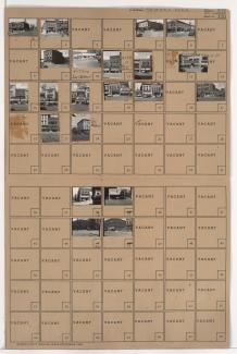
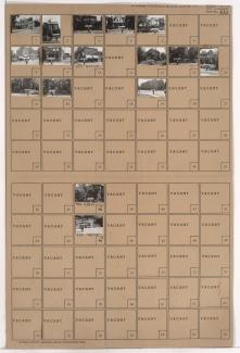
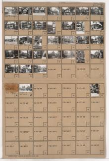
Folder contains photographs of residences, businesses, and other buildings in the Dundee Place addition, from 12th Street south to 13th Street, and Campbell Street east to Harrison Street. Jake's Barber Shop, at 929 East 13th Street, and the Second Ward Republican Club, on 12th Street, are among the buildings pictured.
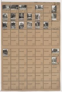
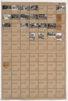
Folder contains photographs of residences, businesses, and other buildings in the Emery Place subdivision, from 13th Street south to 14th Street, and Charlotte Street east to Campbell Street.
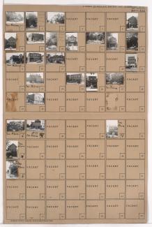
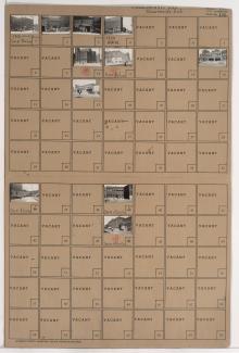
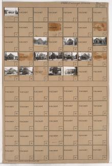
Folder contains photographs of residences, businesses, and other buildings in the Dundee Place subdivision, from 15th Street (later Truman Road) south to 16th Street, and Harrison Street east to Troost Avenue. Rossner Electric Company, at 1009-1011 East 15th, and the Second Ward Independent Democratic Club, at 1005 East 15th, are among the buildings pictured.
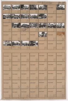
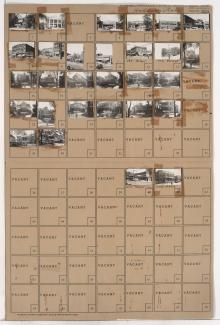
Folder contains photographs of residences, businesses, and other buildings east of downtown Kansas City, from 14th Street south to 15th Street (later Truman Road), and Charlotte Street east to Campbell Street. The Waldron Hotel, at 810 East 15th, and the office of Justice of the Peace Charles Frazier, at 820 East 15th, are among the buildings pictured.
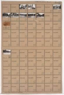
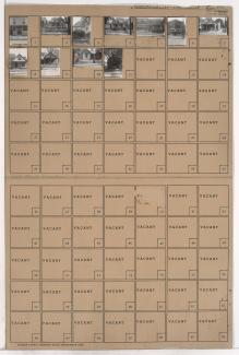
Folder contains photographs of residences, businesses, and other buildings in McGee's Addition, from 14th Street south to 15th Street (later Truman Road), and Holmes Street east to Charlotte Street. The Hillcrest Hotel, at 14th and Holmes, is among the buildings pictured.
Folder contains photographs of businesses and other buildings in downtown Kansas City, from 13th Street south to 14th Street, and Grand Avenue east to McGee Street. The Adams Hotel and Missouri's Electric Store are among the buildings pictured.
Folder contains photographs of businesses and other buildings in downtown Kansas City, from 14th Street south to 15th Street (later Truman Road), and Grand Avenue east to McGee Street. Tim's Aluminum Foundry, at 1404 McGee, Covert Boat & Engine Company, at 1424-1426 McGee, and Opie Brush Company, at 1420-1422 McGee, are among the buildings pictured.
Folder contains photographs of businesses and other buildings in the Crossroads District, from 17th Street south to 18th Street, and Baltimore Avenue east to Main Street. The Globe Storage and Transfer Company, at 1712 Main, and Muehlebach Brewing Company facilities, on 18th Street, are among the buildings pictured.
Folder contains photographs of residences, businesses, and other buildings in the Downtown East neighborhood, from 16th Street south to 17th Street, and Troost Avenue east to Forest Avenue. A Country Club Dairy plant, at 1600 Forest, Senate Market, at 1100 East 17th, and the Glick Flats apartments, at 16th and Troost, are among the buildings pictured.
Folder contains photographs of businesses and other buildings in the Downtown East neighborhood, from 18th Street south to 19th Street, and Lydia Avenue east to Grove Street. Lincoln Tavern, at 1411 East 18th,and Acme Can Company, at 1400 East 19th, are among the buildings pictured.
Folder contains photographs of residences, businesses, and other buildings in the Wendell Phillips neighborhood, from 25th Street south to 26th Street, and Wabash Avenue east to Prospect Avenue. Superior Transfer Service, at 2502-2504 Prospect, Fire Station Number 18, at 2534-2536 Prospect, and the Green Duck Tavern, at 2548 Prospect, are among the buildings pictured.
Folder contains photographs of residences, businesses, and other buildings in the Beacon Hill neighborhood, from 26th Street south to 27th Street, and Troost Avenue east to Forest Avenue.
Folder contains photographs of residences, businesses, and other buildings in the 30th Street south to 31st Street, and Garfield Avenue east to Brooklyn Avenue.
Folder contains photographs of residences and businesses in the Key Coalition neighborhood, from 30th Street south to 31st Street, and Wabash Avenue east to Prospect Avenue. An A&P Supermarket, at 3018-3022 Prospect, and Robert Blond Food Market, at 3042 Prospect, and the Linwood Theater, at 3034-3036 Prospect, are among the buildings pictured.
Folder contains photographs of residences and other buildings in the East Community Team neighborhood, from 17th Street south to 18th Street, and Lawn Avenue east to Lister Avenue. Listern Tavern, at 17th and Lawn, is among the buildings pictured.
Folder contains photographs of residences and other buildings in the East Community Team neighborhood, from 18th Street south to 19th Street, and Norton Avenue east to Jackson Avenue. Rick's Place, at 1838 Jackson, is among the buildings pictured.
Folder contains photographs of residences, apartments, and businesses in the Lykins neighborhood, from Independence Avenue south to 6th Street, and Benton Boulevard east to Indiana Avenue.
Folder contains photographs of residences and businesses in the Lykins neighborhood, from 9th Street south to Cloon Avenue, and Jackson Avenue east to Spruce Avenue.
Folder contains photographs of residences, businesses, and other buildings in the Independence Plaza neighborhood, from 9th Street south to 10th Street, and Prospect Avenue east to Chestnut Avenue.