
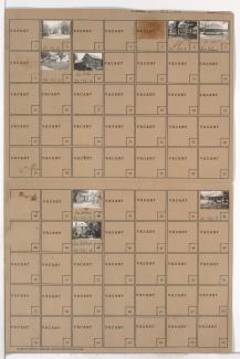
Folder contains photographs of residences and farm buildings in the Country Lane neighborhood south of the 1940 Kansas City city limits, south of 103rd Street and west of Wornall Road.
Folder contains photographs of residences and farm buildings in the Country Lane neighborhood south of the 1940 Kansas City city limits, south of 103rd Street and west of Wornall Road.
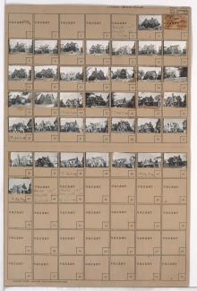
Folder contains photographs of residences and farm buildings in the Lea Manor neighborhood south of the 1940 Kansas City city limits, north of 107th Street and east of State Line Road.
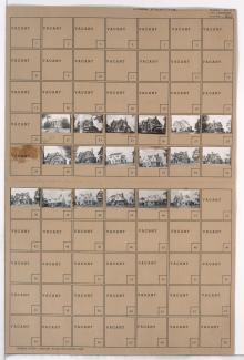
Folder contains a photograph of a residence in the Lea Manor neighborhood south of the 1940 Kansas City city limits, from County Road south to Pioneer Road (later 101st Street), and Woods Road east to Wornall Road.

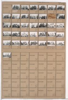
Folder contains photographs of residences in the Romanelli West neighborhood, from 64th Street south to 67th Street, and State Line Road east to Ward Parkway. The Bixby Residence, at 6505 State Line Road, is among the buildings pictured.

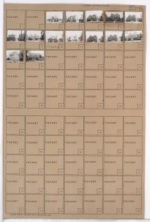
Folder contains photographs of residences in the Romanelli West neighborhood, from 67th Street south to Gregory Boulevard, and State Line Road east to Ward Parkway, including sections of Arno Road, 69th Terrace, Romany Road, 70th Street, and 70th Terrace.
Folder contains photographs of residences in the Romanelli West neighborhood, from 71st Terrace south to 72nd Street, and State Line Road east to Ward Parkway.
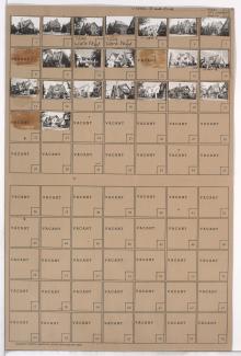
Folder contains photographs of residences in the Romanelli West neighborhood, from Gregory Boulevard south to 71st Terrace, and State Line Road east to Ward Parkway.
Folder contains photographs of residences in the Romanelli West neighborhood, from 72nd Street south to 72nd Terrace, and State Line Road east to Terrace Street.
Folder contains photographs of residences in the Romanelli West neighborhood, from 72nd Terrace south to 73rd Street, and State Line Road east to Terrace Street.
Folder contains photographs of residences in the Romanelli West neighborhood, from Terrace Street south to 73rd Street and east to Ward Parkway.

Folder contains photographs of residences in the Romanelli West neighborhood, from 73rd Street south to 74th Street, and Mercier Street east to Ward Parkway.

Folder contains photographs of residences in the Romanelli West neighborhood, from 73rd Street south to 74th Street, and Terrace Street east to Mercier Street.

Folder contains photographs of residences in the Romanelli West neighborhood, from 73rd Street south to 74th Street, and State Line Road east to Wyoming Street.

Folder contains photographs of residences in the Romanelli West neighborhood, from 73rd Street south to 74th Street, and Wyoming Street east to Terrace Street.

Folder contains photographs of residences in the Romanelli West neighborhood, from 74th Street south to 75th Street, and State Line Road east to Wyoming Street.

Folder contains photographs of residences in the Westmoreland neighborhood, from 74th Street south to 75th Street, and Terrace Street east to Mercier Street.

Folder contains photographs of residences in the Romanelli West neighborhood, from 74th Street south to 75th Street, and Mercier Street east to Ward Parkway.

Folder contains photographs of residences in the Romanelli West neighborhood, from 74th Street south to 75th Street, and Wyoming Street east to Terrace Street.
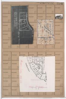
Folder contains a photograph of a residence in the Romanelli West neighborhood, from 76th Terrace south to 77th Street, and Terrace Street east to Ward Parkway. Folder also includes several plat maps.

Folder contains photographs of residences and other buildings in the Romanelli West neighborhood, from 75th Street south to 77th Street, and State Line Road east to Ward Parkway, including sections of Wyoming and Terrace Streets, 76th Terrace, 76th Street, and 75th Terrace. Folder also includes two plat maps of the block, the second of which can be viewed below.