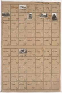
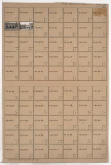
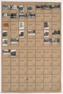
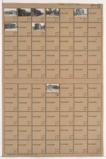
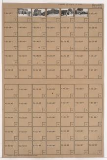
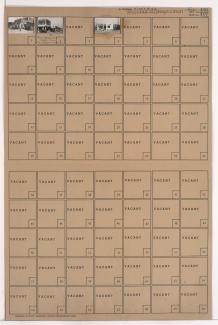
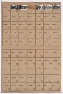
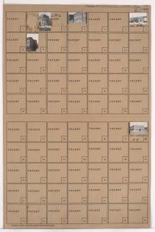
Folder contains photographs of businesses and other buildings in the Cottage Place and East Cottage Place additions, from 5th Street south to 6th Street Trafficway, and Pennsylvania Avenue east to Broadway Boulevard, divided by Washington Street. A Salvation Army industrial building, at 6th and Broadway, and Interstate Tire Company, at 502 Broadway, are among the buildings pictured.
Search
Folder contains photographs of businesses and other buildings in the Cottage Place addition, from 5th Street south to 6th Street Trafficway, and Bluff Street (later Beardsley Road) east to Pennsylvania Avenue.
Folder contains photographs of businesses and apartment buildings adjacent to West Terrace (later, Case) Park, from 6th Street Trafficway south to 12th Street.
Folder contains photographs of a filling station and garage in the Union Place addition, from 6th Street Trafficway south to Maiden Lane, and Pennsylvania Avenue east to Washington Street.
Folder contains photographs of businesses and residences in the Quality Hill neighborhood, from 6th Street Trafficway south to 7th Street, and Washington Street east to Bank Street.
Folder contains photographs of businesses and other buildings in the Quality Hill neighborhood, from 6th Street Trafficway south to 7th Street, and Bank Street east to Broadway Boulevard.
Folder contains photographs of businesses and other buildings in the McDaniels addition, from Independence Avenue south to 6th Street Trafficway, and Walnut Street east to Grand Avenue. The Sterling Hotel and Capitol Hotel, on Walnut Street, are among the buildings pictured.
Folder contains photographs of buildings in the east of downtown Kansas City, from 6th Street Trafficway south to Admiral Boulevard, and Holmes Street east to Charlotte Street. Institutional Church, at 6th and Holmes, is among the buildings pictured.
Folder contains photographs of residences, businesses, and other buildings east of downtown Kansas City, from Independence Avenue south to 6th Street Trafficway, and Holmes Street east to Charlotte Street. Church of God in Christ, at 604 Charlotte Street, Comunale Bakery, at 616 Charlotte, and the 1st Ward Republican Headquarters, at 721 E. Independence Avenue, are among the buildings pictured.
Folder contains photographs of buildings east of downtown Kansas City, from Independence Avenue south to 6th Street Trafficway, and Cherry Street east to Holmes Street. Pagliaccio Spaghetti Restaurant is among the buildings pictured.
Folder contains a photograph of a building east of downtown Kansas City, in the middle of 6th Street Trafficway and west of Holmes Street.
Folder contains photographs of residences and other buildings in Rice's Addition, from 6th Street Trafficway south to Admiral Boulevard, and Cherry Street east to Holmes Street.
Folder contains photographs of businesses and other buildings in Rice's Addition, from Independence Avenue south to 6th Street Trafficway, and Locust Street east to Cherry Street.
Folder contains photographs of apartment buildings and other structures east of downtown Kansas City, from 6th Street Trafficway south to Admiral Boulevard, and Locust Street east to Cherry Street. The Geneva Flats building, at 705-707 Locust, is among the buildings pictured.
Folder contains photographs of businesses and other buildings east of downtown Kansas City, from Independence Avenue south to 6th Street Trafficway, and Oak Street east to Oak Street Trafficway.
Folder contains photographs of businesses east of downtown Kansas City, from Independence Avenue south to 6th Street Trafficway, and Oak Street east to Oak Street Trafficway, diagonally bisected by Locust Street Trafficway.
Folder contains photographs of businesses and other buildings east of downtown Kansas City, from 6th Street Trafficway south to Admiral Boulevard, and Oak Street Trafficway east to Locust Street.
Folder contains photographs of businesses and other buildings in downtown Kansas city, from 6th Street Trafficway south to Admiral Boulevard, and Oak Street east to Oak Street Trafficway. Banker and Merchants Lithographing Company, at 400 East Admiral, is among the buildings pictured.
Folder contains photographs of businesses and other buildings in Ranson & Company's Addition, from 6th Street Trafficway south to 8th Street, and Charlotte Street east to Campbell Street. Gallatin Flats, at 8th and Campbell, is among the buildings pictured. Stacks of bricks at what appears to be a demolition site can be seen in one image.
Folder contains photographs of businesses and other buildings in the McDaniels addition, from Independence Avenue south to 6th Street Trafficway, and McGee Street east to Oak Street.