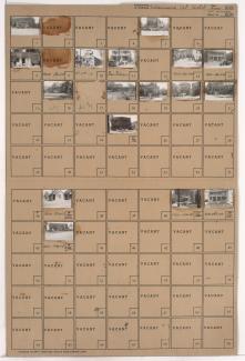
Folder contains photographs of residences, businesses, and other buildings in the 18th and Vine District, from 15th Street (later Truman Road) south to 16th Street, and Euclid Avenue east to Garfield Avenue.
Folder contains photographs of residences, businesses, and other buildings in the 18th and Vine District, from 15th Street (later Truman Road) south to 16th Street, and Euclid Avenue east to Garfield Avenue.
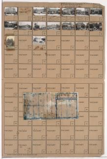
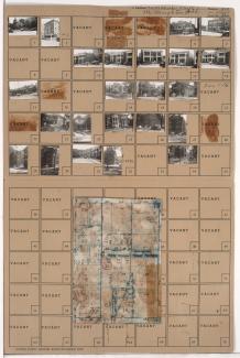
Folder contains photographs of residences, businesses, and other buildings in the North Hyde Park neighborhood, from 31st Street south to Linwood Boulevard, and Harrison Street east to Troost Avenue. The Wirthman Building, including the Isis Theater and Crown Drugs, at 3100 Troost, Gehr's Cafe, at 3128 Troost, and a Woolworth's store, at 3118-3120 Troost, are among the buildings pictured. Folder also includes a plat map of the block.
Folder contains photographs of businesses and other buildings in downtown Kansas City, from 10th Street south to 11th Street, and Oak Street east to Locust Street. The Claridge and Drake Hotels, on Locust, and the College of Commerce, at 11th and Locust, are among the buildings pictured.
Folder contains photographs of businesses and other buildings in downtown Kansas City, from 11th Street south to 12th Street, and Locust Street east to Cherry Street. The Municipal Court and Police Headquarters Building, at 1125 Locust, and Kansas City Junior College, at 11th and Locust, are among the buildings pictured.

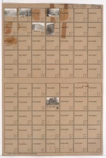
Folder contains photographs of residences and other buildings in the Lykins neighborhood, from 10th Street south to 11th Street, and Indiana Avenue east to Bales Avenue. Finlay Engineering College, at 10th and Indiana, is among the buildings pictured.

Folder contains photographs of residences and other buildings in the Southmoreland neighborhood, from 44th Street south to 45th Street, and Main Street east to Warwick Boulevard, including a section of Walnut Street. Kansas City Art Institute buildings, on Warwick, are among the buildings pictured. Folder also includes a plat map of the block.
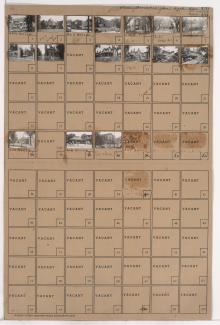
Folder contains photographs of residences, businesses, and apartment buildings in the North Hyde Park neighborhood, from Linwood Boulevard south to 33rd Street, and Harrison Street east to Troost Avenue, including sections of 32rd Terrace and Cherry Lane. The Carlton Hotel, at 1007-1009 East Linwood, and the Blue Bird Cafeteria, at 3210 Troost, are among the buildings pictured. Folder also includes a plat map of the block.

Folder contains photographs of Rockhurst College and High School buildings, from Rockhurst Road south to 53rd Street, and Troost Avenue east to Lydia Avenue. Folder also includes a plat map of the block.

Folder contains photographs of buildings on University of Kansas City (later University of Missouri-Kansas City) campus, from 51st Street south to 52nd Street, and Holmes Street east to Rockhill Road. Folder also includes a plat map of the block.
Folder contains photographs of residences, businesses, and other buildings in the Paseo West neighborhood, from Independence Avenue south to Admiral Boulevard, and Lydia Avenue east to Paseo Boulevard. Mid-West Medical College, at 1424 Admiral, is among the buildings pictured.
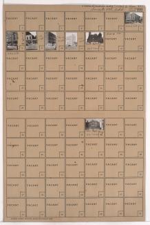
Folder contains photographs of residences and apartment buildings in the Parkview neighborhood, from Independence Avenue south to 7th Street, and Garfield Avenue east to Brooklyn Avenue. The Italian Baptist Mission, on Brooklyn, Passantino Brothers Funeral Home, at 2117 Independence, and Kansas City College of Osteopathy and Surgery facilties, at Independence and Garfield, are among the buildings pictured.