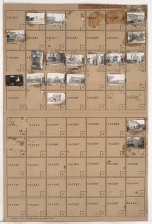
Folder contains photographs of residences and businesses in the 18th and Vine District, from 17th Street south to 18th Street, and Agnes Avenue east to Walrond Avenue.
Folder contains photographs of residences and businesses in the 18th and Vine District, from 17th Street south to 18th Street, and Agnes Avenue east to Walrond Avenue.
Folder contains photographs of residences, businesses, and other buildings in the Volker neighborhood, from 31st Street south to 32nd Street, and Bell Street east to Roanoke Street. Tnemec Company, at 3122-3124 Roanoke, and Battenfeld Grease and Oil Company, at 3128-3130 Roanoke, are among the buildings pictured.

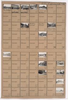
Folder contains photographs of businesses and other buildings in the Crossroads District, from 21st Street south to 22nd Street, and Charlotte Street east to Campbell Street. Schulze Baking Company, at 22nd and Campbell, and Sumner School, at 22nd and Charlotte, are among the buildings pictured.
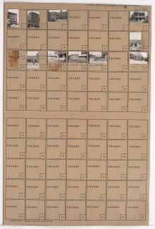
Folder contains photographs of businesses and other buildings in the Crossroads District, from 20th Street south to 21st Street, and Walnut Street east to Grand Avenue. The Fleming Place building, at 2030 Grand, is among the buildings pictured.
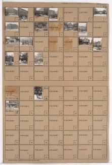
Folder contains photographs of businesses and other buildings in the Crossroads District, from 20th Street south to Pershing Road, and Main Street east to Walnut Street and Grand Avenue. Walnut Storage, at 2020-2024 Walnut, is among the buildings pictured. A side view of Union station, including the rail lines leading to it, are also pictured.

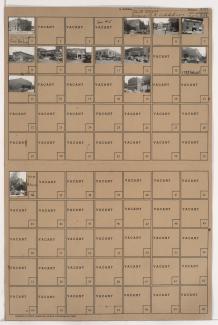
Folder contains photographs of businesses and other buildings in the Crossroads District, from 21st Street south to Milwaukee Avenue (22nd Street), and from Northwestern Avenue east to Central Street. The Meriden Creamery building, at 2100 Central, the Crown Drug warehouse, at 2108-2112 Central, and a Western Auto warehouse, at 2114 Central, are among the buildings pictured.
Folder contains photographs of businesses and other buildings in the Crossroads District, from 20th Street and Milwaukee Avenue (22nd Street) south to Pershing Road, and from West Pennway east to Main Street. Church's Lunch, at 2012 Main, Hotel Terminal, at 2016 Main, and the Freight House Building, on 22nd Street, are among the buildings pictured. Kansas City's Union Station, on Pershing, and the adjacent Railway Exchange building, are also included.
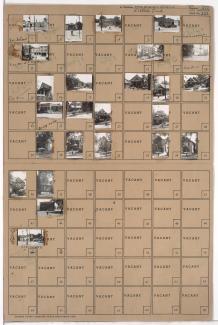
Folder contains photographs of residences, businesses, and other buildings in the Paseo West neighborhood, from 12th Street south to 13th Street, and Troost Avenue east to Forest Avenue. Pennant Cigar Store, at 1109 East 12th, and the Salvation Army Store, at 1111 East 12th, are among the buildings pictured.
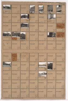
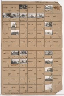
Folder contains photographs of businesses and other buildings in the Crossroads District, from 17th Street south to 18th Street, and Locust Street east to Cherry Street. The J.T. Wiles Electric Company, on 18th Street, and Missouri Valley Electric Company, at 1709-1711 Locust, are among the buildings pictured.
Folder contains photographs of residences and businesses in the Northeast Industrial District, on two parcels: one from Owen Avenue south to Lorene Avenue, and from Block 21 east to Bellefontaine Avenue, and the other from Gardner Avenue south to Owen Avenue and Nicholson Avenue, and Bellefontaine Avenue east to Monroe Avenue.

Folder contains photographs of residences and other buildings in the East Community Team neighborhood, from 19th Street south to 20th Street, and Indiana Avenue east to Askew Avenue. A Kansas City Gas Company building and natural gas storage tank, at 20th and Indiana, are among the buildings pictured.

Folder contains a photograph of a building in the East Kansas addition, from 2nd Street south to 3rd Street, and Holmes Street east to Charlotte Street. A Kansas City Power and Light Company transformer station, at 205-209 Holmes, is pictured.

Folder contains photographs of businesses and other buildings in the River Market neighborhood, from 4th Street south to 5th Street, and Wyandotte Street east to Delaware Street. Mahoney Tobacco Company, at 128 West 5th, Squire Electric Company, at 401 Wyandotte, and West Side Barber Shop, at 124 West 5th, are among the businesses pictured.

Folder contains photographs of residences and other buildings in the West Side neighborhood, from 26th Street south to 27th Street, and Madison Street east to Summit Street. Kansas City Power and Light Company Substation A, at 27th and Madison, is among the buildings pictured.