Tax Assessment Block Folder, Kansas City, MO, District 14, Block 37

Folder contains photographs of businesses in the Mount Cleveland neighborhood, from Blue Ridge Road south to 51st Street, and Cleveland Avenue east to Jackson Avenue.
Folder contains photographs of businesses in the Mount Cleveland neighborhood, from Blue Ridge Road south to 51st Street, and Cleveland Avenue east to Jackson Avenue.
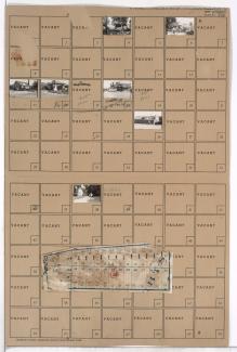
Folder contains photographs of residences and businesses in the North Town Fork Creek neighborhood, from Blue Ridge Road south to 49th Terrace, and Swope Parkway east to Cleveland Avenue. Folder also includes a plat map of the block.

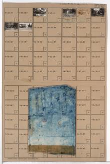
Folder contains photographs of residences in the Mount Cleveland neighborhood, from Blue Ridge Road south to 50th Terrace, and Jackson Avenue east to Kensington Avenue. Folder also includes a plat map of the block.

Folder contains photographs of residences and other buildings in the Mount Cleveland neighborhood, from Blue Ridge Road south to 50th Terrace, and Kensington Avenue east to Elmwood Avenue. Folder also includes a plat map of the block.

Folder contains a photograph of a residence in the Sheraton Estates neighborhood, from Blue Ridge Road south to 51st Street, and Lawn Avenue east to Lister Avenue. Folder also includes a plat map of the block.

Folder contains photographs of residences in the Brown Estates neighborhood, from Blue Ridge Road south to 51st Street, and Brighton Avenue east to Denver Avenue.

Folder contains photographs of residences in the Brown Estates neighborhood, from Blue Ridge Road south to 51st Street, and Denver Avenue east to Hardesty Avenue. Folder also includes a plat map of the block.

Folder contains photographs of residences in the Brown Estates neighborhood, from Blue Ridge Road south to 51st Street, and Hardesty Avenue east to Oakley Avenue.
Folder contains photographs of residences and businesses in the Brown Estates neighborhood, from Blue Ridge Road south to 51st Street, and Oakley Avenue east to Topping Avenue. Folder also includes a plat map of the block.

Folder contains photographs of residences and businesses in the Eastwood Hills West neighborhood, from 49th Street south to Blue Ridge Road, and Hardesty Avenue east to Coal Mine Road.