Tax Assessment Block Folder, Kansas City, MO, District 2, Block 85

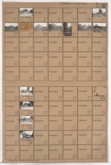
Folder contains photographs of residences in the McKinney Heights subdivision, from Scarritt Avenue south to Windsor Avenue, and Mersington Avenue east to Clinton Place.
Folder contains photographs of residences in the McKinney Heights subdivision, from Scarritt Avenue south to Windsor Avenue, and Mersington Avenue east to Clinton Place.
Folder contains photographs of residences in the Northeast Industrial District, from the Missouri River south to Empire Road and Dowden Place, and Monroe Avenue east to Jackson Avenue and Myrtle Avenue.
Folder contains a photograph of a residence in the Northeast Industrial District, from Frankfort Avenue south to Empire Road, and Norton Avenue east to Jackson Avenue.
Folder contains photographs of residences and other buildings in the Foxtown East neighborhood, from 67th Street south to 67th Terrace, and Myrtle Avenue east to Jackson Avenue.

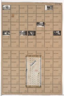
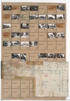
Folder contains photographs of residences in the Foxtown East neighborhood, from 67th Terrace south to 68th Street, and Myrtle Avenue east to Jackson Avenue. Folder also includes a plat map of the block.
Folder contains photographs of residences and other buildings in the Marlborough East neighborhood, from 75th Street south to the 1940 Kansas City city limits, and Indiana Avenue east to Jackson Avenue, including section a section of 77th Street.
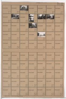
Folder contains photographs of residences in the Swope Parkway neighborhood, from 57th Street south to 58th Street, and Norton Avenue east to Jackson Avenue. Folder also includes a plat map of the block.

Folder contains photographs of residences in the Swope Parkway neighborhood, from 58th Street south to 59th Street, and Norton Avenue east to Jackson Avenue. Folder also includes a plat map of the block.
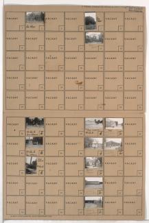
Folder contains photographs of residences in the Swope Parkway neighborhood, from 56th Street south to 56th Terrace and 57th Street, and from Swope Parkway and Myrtle Avenue east to Jackson Avenue. Folder also includes a plat map of the block.

Folder contains photographs of residences in the Swope Parkway neighborhood, from 55th Street south to 56th Street, and Norton Avenue east to Jackson Avenue.