Tax Assessment Block Folder, Kansas City, MO, District 2, Block 106
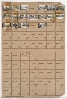
Folder contains photographs of residences in the East Melrose subdivision, from Norledge Avenue south to Scarritt Avenue, and Gladstone Boulevard east to Mersington Avenue.
Folder contains photographs of residences in the East Melrose subdivision, from Norledge Avenue south to Scarritt Avenue, and Gladstone Boulevard east to Mersington Avenue.
Folder contains photographs of residences in the Scarritt Point neighborhood, from Sunrise Drive south to Norledge Avenue, and Askew Avenue east to Mersington Avenue.

Folder contains photographs of residences in the McKinney Heights subdivision, from Norledge Avenue south to Scarritt Avenue, and Clinton Place east to Jackson Avenue.

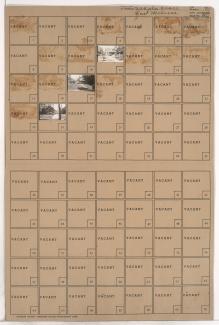
Folder contains photographs of residences and apartment buildings in the McKinney Heights subdivision, from Norledge Avenue south to Scarritt Avenue, and Mersington Avenue and Gladstone Boulevard east to Clinton Place.

Folder contains photographs of residences in the Scarritt Point neighborhood, from Sunrise Drive south to Norledge Avenue, and Mersington Avenue east to Jackson Avenue, including a segment of Clinton Place.
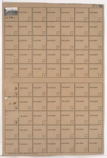
Folder contains a photograph of the Montgomery Ward building at 6220 St. John Avenue, located in an area bordered by Belmont Boulevard/Chouteau Trafficway, St. John Avenue, Norledge Avenue, and Beacon Avenue.

Folder contains photographs of residences in the North Terrace Heights subdivision, from Norledge Place south to Scarritt Avenue, and Kensington Avenue east to Elmwood Avenue.

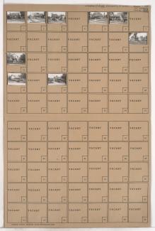
Folder contains photographs of residences and other buildings in the Dofflemeyer Place addition, from Norledge Place south to Scarritt Avenue, and Jackson Avenue east to Kensington Avenue.
Folder contains photographs of residences in the Cliff Drive Park subdivision, from Sunrise Drive south to Norledge Place, and Jackson Avenue east to Kensington Avenue, and including a section of Cliff Drive Place.

Folder contains photographs of residences in the Cliff Drive Park subdivision, from Sunrise Drive south to Norledge Place, and Kensington Avenue east to Elmwood Avenue.