Tax Assessment Block Folder, Kansas City, MO, District 16, Block 83
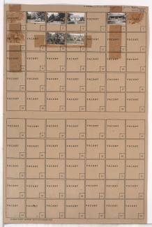
Folder contains photographs of residences in the Walnut Grove neighborhood, from 73rd Street south to 74th Street, and Brooklyn Avenue east to Park Avenue.
Folder contains photographs of residences in the Walnut Grove neighborhood, from 73rd Street south to 74th Street, and Brooklyn Avenue east to Park Avenue.
Folder contains photographs of residences and other buildings in the Walnut Grove neighborhood, from 73rd Street south to 74th Street, and Park Avenue east to Olive Street.
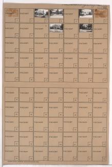
Folder contains photographs of residences in the Walnut Grove neighborhood, from 72nd Street south to 73rd Street, and Park Avenue east to Olive Street.

Folder contains photographs of residences in the Walnut Grove neighborhood, from 72nd Street south to 73rd Street, and Brooklyn Avenue east to Park Avenue.

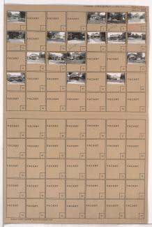
Folder contains photographs of residences in the Tri-Blenheim neighborhood, from Meyer Boulevard south to 67th Street, and Park Avenue east to Olive Avenue.

Folder contains photographs of residences in the Tri-Blenheim neighborhood, from Meyer Boulevard south to 67th Street, and Brooklyn Avenue east to Park Avenue.

Second of two folders containing photographs of residences in the Citadel neighborhood, from 59th Street south to 63rd Street, and Blue Hills Road east to Park Avenue, including sections of Brooklyn Avenue and 62nd Street. Folder also includes a plat map for a portion of the area, northwest of 62nd Street and Park Avenue along Brooklyn Avenue.
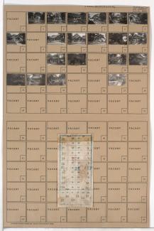
Folder contains photographs of residences in the Blue Hills neighborhood, from 62nd Street south to 63rd Street, and Park Avenue east to Olive Street. Folder also includes a plat map of the block.

Folder contains photographs of residences in the Citadel neighborhood, from 62nd Street south to 63rd Street, and Brooklyn Avenue east to Park Avenue. A plat map of the block was incorrectly scanned with Block 156 and is visible here: http://kc1940.org/districts/district-no-13-map-kansas-city-jackson-coun….

Map of block in the Blue Hills neighborhood, from 60th Street south to 62nd Street, and Park Avenue east to Prospect Avenue, including sections of Wabash Avenue and Olive Street, containing information about tax assessment values of included properties, and illustrating lot numbers for the block.